Near Chippawa in Niagara Region, Ontario — Central Canada (North America)
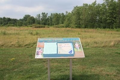
Chippawa Battlefield Panel 4
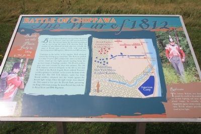
Battle on the Plain
— July 5, 1814 4:30 p.m. —
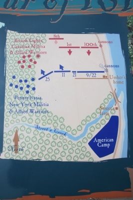
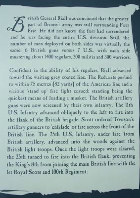
Confident in the abilities of his regulars, Riall advanced towards the waiting grey-coated line. The Redcoats pushed to within 75 meters (82 yards) of the American line and a vicious stand up� fire fight ensued: standing being the quickest means of loading a musket. The British artillery guns were now screened by their own infantry. The 11th U.S. Infantry advanced obliquely to the left to fire into the flank of the British brigade. Scott ordered Towson's artillery gunners to enfilade or fire across the front of the British line. The 25th U.S. Infantry, under fire from British artillery, advanced into the woods against the British light troops. Once the light troops were cleared, the 25th turned to fire into the British flanks, preventing the King's 8th from joining the main British line with the 1st Royal Scots and 100th Regiment.
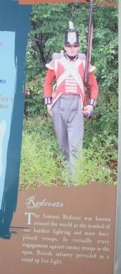
Redcoats:
The famous redcoat was known around the world as the symbol for the hardest fighting and most disciplined troops. In virtually every engagement against enemy troops in the open, British infantry prevailed in a stand up fire fight.
Erected 2001 by The Niagara Parks Commission.
Topics. This historical marker is listed in these topic lists: Colonial Era • War of 1812. A significant historical year for this entry is 1400.
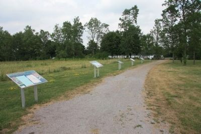
Location. 43° 3.142′ N, 79° 1.476′ W. Marker is near Chippawa, Ontario, in Niagara Region. Marker can be reached from Niagara River Parkway just west of Edgworth Road, on the right when traveling south. This historical marker is located on the Canadian side of the Niagara River, a short distance south of Chippawa, Ontario, and opposite Navy Island, in the Chippawa Battlefield Park. This historical marker is part of the Chippawa Battlefield Park Walking Tour - and is one of six Plexiglass panels, that is freestanding in a row along the northern boundary of the park, approximately 15 yards from the Chippawa Battlefield Monument. Touch for map. Marker is in this post office area: Chippawa ON L2E 6S6, Canada. Touch for directions.
Other nearby markers. At least 8 other markers are within walking distance of this marker. Chippawa Battlefield Panel 5 (here, next to this marker); Chippawa Battlefield Panel 3 (here, next to this marker); Chippawa Battlefield Panel 2 (a few steps from this marker); Chippawa Battlefield Panel 6 (a few steps from this marker);
Chippawa Battlefield Panel 1 (a few steps from this marker); Battle of Chippawa (within shouting distance of this marker); a different marker also named The Battle of Chippawa (within shouting distance of this marker); a different marker also named The Battle of Chippawa (about 150 meters away, measured in a direct line). Touch for a list and map of all markers in Chippawa.
Related markers. Click here for a list of markers that are related to this marker. To better understand the relationship, study each marker in the order shown.
Credits. This page was last revised on September 27, 2019. It was originally submitted on November 11, 2011, by Dale K. Benington of Toledo, Ohio. This page has been viewed 718 times since then and 11 times this year. Photos: 1, 2, 3, 4, 5, 6. submitted on November 13, 2011, by Dale K. Benington of Toledo, Ohio.
