Near Chippawa in Niagara Region, Ontario — Central Canada (North America)
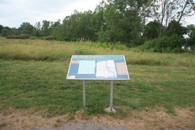
Chippawa Battlefield Panel 6
The Aftermath
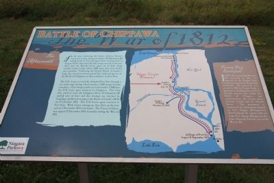
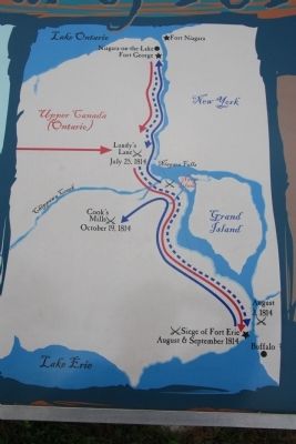
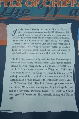
The U.S. Army successfully defended Fort Erie through a six week siege during which another 3,200 troops became casualties. After being reinforced with another 5,000 men, the U.S. Army again advanced to Chippawa. This time they tried to cross the Chippawa River 12 kilometers (9 miles) west of here and this attempt was checked by Canadian and British troops at the Battle of Cook's Mills on 19 October 1814. The U.S. forces again returned to Fort Erie. With winter coming on, they blew up the Fort and on 5 November 1814 went home. The Treaty of Ghent was signed 24 December 1814, formally ending the War of 1812.
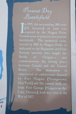
Present Day Battlefield
In 1995, the surrounding 300 acres (121 hectares) of land was acquired by the Niagara Parks Commission to preserve this pristine battlefield. The national cairn, erected in 2001 by Niagara Parks, is dedicated to the Regiments and First Nations warriors who fought the Battle of Chippawa and commemorates th lasting peace between Canada and the United States. The monument is constructed of cobblestones donated by Fort Niagara (Youngstown, New York) and the cannon balls are from Fort George (Niagara-on-the-Lake, Ontario), both key sites in the War of 1812.
Erected 2001 by The Niagara Parks Commission.
Topics. This historical marker is listed in these topic lists: Colonial Era • War of 1812. A significant historical date for this entry is October 19, 1814.
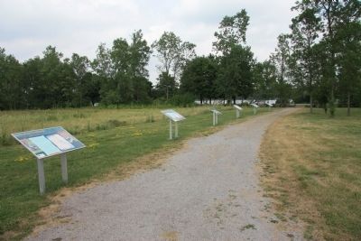
Location. 43° 3.145′ N, 79° 1.466′ W. Marker is near Chippawa, Ontario, in Niagara Region. Marker can be reached from Niagara River Parkway just west of Edgworth Road, on the right when traveling south. This historical marker is located on the Canadian side of the Niagara River, a short distance south of Chippawa, Ontario, and opposite Navy Island, in the Chippawa Battlefield Park. This historical marker is part of the Chippawa Battlefield Park Walking Tour - and is one of six Plexiglass panels, that is freestanding in a row along the northern boundary of the park, approximately 15 yards from the Chippawa Battlefield Monument. Touch for map. Marker is in this post office area: Chippawa ON L2E 6S6, Canada. Touch for directions.
Other nearby markers. At least 8 other markers are within walking distance of this marker. Chippawa Battlefield Panel 5 (here, next to this marker); Chippawa Battlefield Panel 4
(a few steps from this marker); Chippawa Battlefield Panel 3 (a few steps from this marker); Chippawa Battlefield Panel 2 (within shouting distance of this marker); Chippawa Battlefield Panel 1 (within shouting distance of this marker); Battle of Chippawa (within shouting distance of this marker); a different marker also named The Battle of Chippawa (within shouting distance of this marker); a different marker also named The Battle of Chippawa (about 150 meters away, measured in a direct line). Touch for a list and map of all markers in Chippawa.
Related markers. Click here for a list of markers that are related to this marker. To better understand the relationship, study each marker in the order shown.
Credits. This page was last revised on September 27, 2019. It was originally submitted on November 11, 2011, by Dale K. Benington of Toledo, Ohio. This page has been viewed 634 times since then and 8 times this year. Photos: 1, 2, 3, 4, 5, 6. submitted on November 13, 2011, by Dale K. Benington of Toledo, Ohio.
