Red Wing in Goodhue County, Minnesota — The American Midwest (Upper Plains)
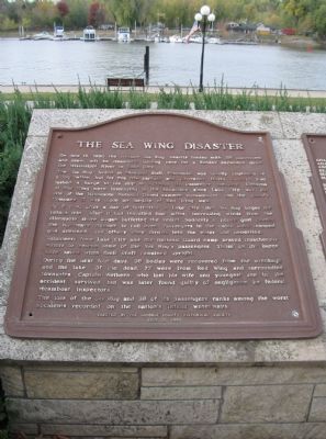
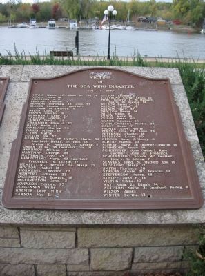
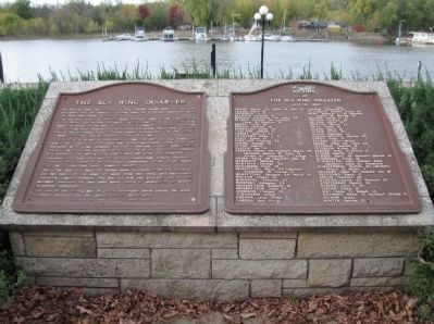
The Sea Wing Disaster / Victims of the Sea Wing Disaster
The Sea Wing, based in Diamond Bluff, Wisconsin, was usually employed as a log-rafter, but for this trip captain and co-owner David Wethern had lashed a barge to his ship to increase its passenger capacity. Citizens of Red Wing were interested in the excursion since Lake City was the site of the Minnesota National Guard summer encampment, and the guard's Company G was made up largely of Red Wing men.
At 8 p.m., after a day of festivities in Lake City, the Sea Wing began the return trip. After it had travelled four miles, increasing winds from the Minnesota shore began buffeting the vessel. Suddenly a heavy gust caused the top-heavy steamer to roll over. Passengers in the cabin were trapped and drowned, and others were thrown into the water and imperiled.
Volunteers from Lake City and the National Guard camp braved treacherous waters to rescue some of the Sea Wing's passengers. Those on the barge were saved when their craft remained upright.
During the next four days, 98 bodies were recovered from the wreckage and the lake. Of the dead, 77 were from Red Wing and surrounding townships. Captain Wethern, who lost his wife and youngest son in the accident, survived but was later found guilty of negligence by federal steamboat inspectors.
The loss of the Sea Wing and 98 of its passengers ranks among the worst accidents recorded on the nation's inland waterways.
July 13, 1990
of
The Sea Wing Disaster
July 13, 1890
Adams Mamie, 20; Willie, 16; Ella, 14 Adams John, 19 Anderson A. O. Bearson Phoebe, 15 Behrens Dorothea, 33; John, 33 Blaker Phoebe, 35 (mother); Cena, 18; Delbert, 15 Brenn Louis, 25 Brown Charles, 19 Burkhard Katie, 20 Carlson Joseph, 21 Christ Fred J., 22 Crawford Eliza J., 27 Daily Katie, 21 Dinslage Charles, 33 Fisher Minnie, 18 Flynn Mattie Fulton Ira, 37 Gerken Peter, 45 (father); Maria, 39 (mother); Henry, 15; Emil, 13; Alvina, 10; Amandus, 7; George, 5 Green Eliza, 36 (mother); Ida, 18 Harrison Melissa, 17 Hartman George, 44 Hattemer Fred, 25 Hempftling Mary, 43 (mother); Frederick, 19; Lizzie, 17 Hempftling Herman, 24; Mary, 21 Holton Mabel, 13 Horwedel Theodor, 27 Humpert Johanna, 23 Ingebretson Edward, 18 Ingebretson John, 13 Johnson Corden, 25 Jurgensen Willie Kremer Leon; Millie Larson Mrs. Ed Leeson Thomas, 17 Lillyblad Gustaf Lenus, 10 Mero Roderic L., 51 (father); Austin, 19; Myrtle, 14 Nelson Emma C., 21 Nelson George, 29 Nelson Mary, 37 Newton Henry, 14 Niles Millie, 16 Olson Mary, 16 Olson Peter, 30 Olson Randina, 24 O'Shaughnessy Martin, 26 Oskey Oren, 17 Palmer Alice; Nettie Persig Julia, 29; Anna, 26 Peterson Charles, 16 Peterson Knute, 30 Rehder Rosa, 11; Henry, 8 Scherf Martin, 23 Schref Mary, 36 (mother); Hattie, 16 Schneider Annie, 19 Schoeffler John (father); Kate (mother); John Jr.; Frederick Schulenberg Sophia, 40 (mother); Henry, 11; Minna, 7 Seavers Fred, 50 (father); Ida, 16 Skoglund Mary, 17 Smith Florence, 28 Staiger Annie, 20; Frances, 18 Steffenson Henry, 18 Strope John F., 14 Vieths Rikka, 10 Way Adda, 21; Ednah, 14 Wethern Nellie,
31 (mother); Perley, 8
Wilson James
Winter Bertha, 13
Erected 1990 by the Goodhue County Historical Society.
Topics and series. This historical marker is listed in this topic list: Waterways & Vessels. In addition, it is included in the Lost at Sea series list. A significant historical month for this entry is July 1863.
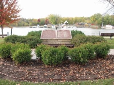
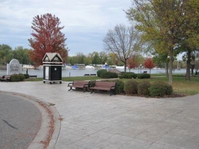
Location. 44° 34.011′ N, 92° 32.246′ W. Marker is in Red Wing, Minnesota, in Goodhue County. Marker can be reached from the intersection of Broad Street and Levee Road. Marker is near the Mississippi River in Levee Park. Touch for map. Marker is at or near this postal address: 432 Levee Street, Red Wing MN 55066, United States of America. Touch for directions.
Other nearby markers. At least 8 other markers are within walking distance of this marker. Chicago, Milwaukee & St. Paul Railroad Depot (within shouting distance of this marker); Goodhue County Veterans Memorial (approx. 0.2 miles away); Studebaker Park (approx. 0.2 miles away); National Newspaper Association (approx. 0.2 miles away); T.B. Sheldon Memorial Auditorium (approx. 0.2 miles away); Civil War Memorial (approx. 0.4 miles away); Kiwanis Stairway (approx. half a mile away); Geology of Minnesota (approx. 0.7 miles away). Touch for a list and map of all markers in Red Wing.
Also see . . .
1. Minnesota Historical Society. Sea Wing Disaster. (Submitted on November 12, 2011.)
2. Sea Wing Disaster.
Grave sites of the Sea Wing victims. (Submitted on November 12, 2011.)
Credits. This page was last revised on June 7, 2021. It was originally submitted on November 12, 2011, by Keith L of Wisconsin Rapids, Wisconsin. This page has been viewed 2,390 times since then and 89 times this year. Photos: 1, 2, 3, 4, 5. submitted on November 12, 2011, by Keith L of Wisconsin Rapids, Wisconsin.
