Queenston in Niagara-on-the-Lake in Niagara Region, Ontario — Central Canada (North America)
Brock's Cenotaph
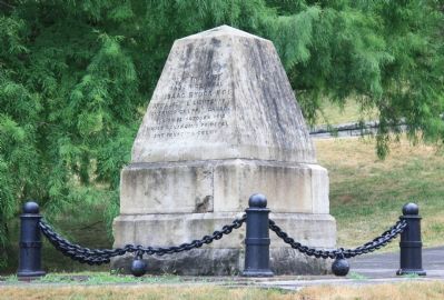
Photographed by Dale K. Benington, July 28, 2011
1. Brock's Cenotaph Marker
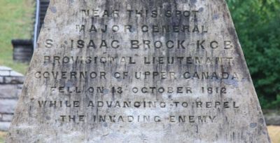
Major-General
Sir Isaac Brock, K.C.B.
Provisional Lieutenant
Governor of Upper Canada
fell on 13 - October, 1812
while advancing to repel
the invading enemy.
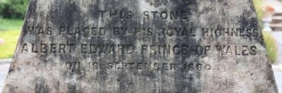
[Text on South Side of Marker]:
Was placed by His Royal Highness
Albert Edward, Prince of Wales
on 18th September, 1860.
Erected 1860.
Topics. This historical marker is listed in this topic list: War of 1812. A significant historical date for this entry is September 18, 1860.
Location. 43° 9.738′ N, 79° 3.271′ W. Marker is in Niagara-on-the-Lake, Ontario, in Niagara Region. It is in Queenston. It is on Clarence Street just west of Queenston Street. This historical monument is located on the Canadian side of the Niagara River, on the southern edge of a residential neighborhood, in a small community park with several other historical monuments, at the base of the Niagara Escarpment. Touch for map. Marker is at or near this postal address: 20 Clarence Street, Niagara-on-the-Lake ON L0S 1L0, Canada. Touch for directions.

Regionally, this marker is on the Golden Horseshoe and in Niagara Canada.
this page online
Other nearby markers. At least 8 other markers are within walking distance of this marker: Indians at Queenston Heights (a few steps from this marker); 'Alfred' (a few steps from this marker); Home of William Lyon Mackenzie (within shouting distance of this marker); Seeds Of Reform (within shouting distance of this marker); Gordon's Quarter Medium Press (within shouting distance of this marker); The Colonial Advocate (about 90 meters away, measured in a direct line); Brock Dead House (about 210 meters away); Laura Ingersoll Secord 1775-1868 (about 210 meters away). Touch for a list and map of all markers in Niagara-on-the-Lake.
Another marker is no longer nearby. The Counter-Offensive Takes Shape / La contre-offensive prend forme (was about 180 meters away but has been confirmed missing).
Also see . . . Isaac Brock Biography.
Photographed by Dale K. Benington, July 28, 2011
2. Brock's Cenotaph Marker
Close-up view of the text on north side (front side) of historical marker.
Photographed by Dale K. Benington, July 28, 2011
3. Brock's Cenotaph Marker
Close-up view of the text on south side (back side) of historical marker.
Photographed by Dale K. Benington, July 28, 2011
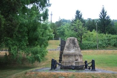
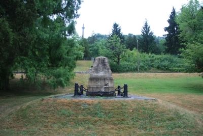
4. Brock's Cenotaph Marker
View of the north side (front side) of the monument situated at the base of the Niagara Escarpment and a distant view of the Brock Monument situated at the top of the Niagara Escarpment.
Photographed by Dale K. Benington, July 28, 2011
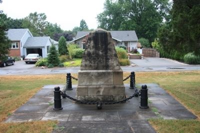
5. Brock's Cenotaph Marker
View of the south side (back side) of historical marker situated on the northern edge of a residential neighborhood.
Photographed by Dale K. Benington, July 28, 2011
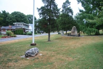
6. Brock's Cenotaph Marker
View looking east along Clarence Street of the featured historical marker, situated in a community park between two other historical monuments.
Photographed by Dale K. Benington, July 28, 2011
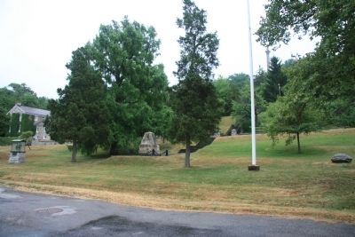
7. Brock's Cenotaph Marker
View looking south of the featured historical marker, situated in a community park between two other historical monuments, with the Niagara Escarpment in the background.
Photographed by Dale K. Benington, July 28, 2011
8. Brock's Cenotaph Marker
Credits. This page was last revised on February 25, 2026. It was originally submitted on November 13, 2011, by Dale K. Benington of Toledo, Ohio. This page has been viewed 997 times since then and 53 times this year. Photos: 1, 2, 3, 4, 5, 6, 7, 8. submitted on November 18, 2011, by Dale K. Benington of Toledo, Ohio.
