Tellico Plains in Monroe County, Tennessee — The American South (East South Central)
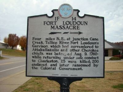
Fort Loudoun Massacre
Erected by Tennessee Historical Commission. (Marker Number 1F 14.)
Topics and series. This historical marker is listed in these topic lists: Colonial Era • Forts and Castles • Native Americans. In addition, it is included in the Tennessee Historical Commission series list. A significant historical date for this entry is August 9, 1805.
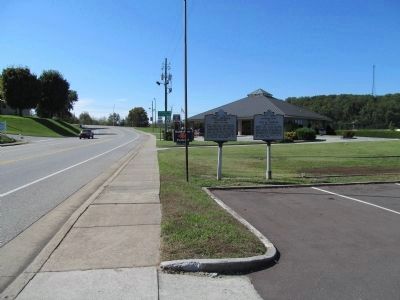
Location. 35° 22.027′ N, 84° 17.98′ W. Marker is in Tellico Plains, Tennessee, in Monroe County. Marker is at the intersection of Cherohala Skyway (Tennessee Route 165) and Hunt Street, on the right when traveling west on Cherohala Skyway. Touch for map. Marker is at or near this postal address: 209 Cherohala Skyway, Tellico Plains TN 37385, United States of America. Touch for directions.
Other nearby markers. At least 8 other markers are within 8 miles of this marker, measured as the crow flies. Boyhood Home of Ray H. Jenkins (here, next to this marker); The Tennessee Overhill Experience (a few steps from this marker); Cherokee Heritage Trails (about 700 feet away, measured in a direct line); Tellico Iron Works (about 700 feet away); Scott Mansion (approx. 1.4 miles away); Early Gold Mining (approx. 7Ĺ miles away); Unicoi Turnpike Trail (approx. 7Ĺ miles away); Gold Mining at Coker Creek (approx. 7Ĺ miles away). Touch for a list and map of all markers in Tellico Plains.
Credits. This page was last revised on June 16, 2016. It was originally submitted on November 16, 2011, by Judith Barber of Marietta, Georgia. This page has been viewed 2,189 times since then and 109 times this year. Photos: 1. submitted on November 16, 2011, by Judith Barber of Marietta, Georgia. 2. submitted on October 12, 2012, by Judith Barber of Marietta, Georgia. • Bernard Fisher was the editor who published this page.

