Near Valdez in Valdez-Cordova Census Area, Alaska — Northwest (North America)
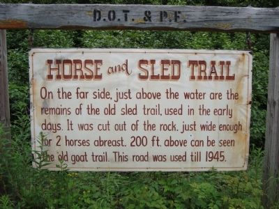
Horse and Sled Trail
Erected by Department of Transportation & P.F.
Topics. This historical marker is listed in this topic list: Roads & Vehicles. A significant historical year for this entry is 1945.
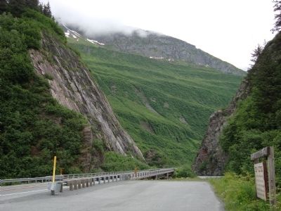
Location. 61° 5.108′ N, 145° 53.636′ W. Marker is near Valdez in Valdez-Cordova Census Area, Alaska. Marker is on Richardson Highway (Alaska Route 4 at milepost 15.3). The Richardson Highway mile posts were established before the 1964 Good Friday earthquake destroyed the town of Valdez. 'Old' Valdez was abandoned and 'New' Valdez was established four miles further down the road, thus the mile post for 'New' Valdez is -4 miles. Touch for map. Marker is in this post office area: Valdez AK 99686, United States of America. Touch for directions.
Other nearby markers. At least 2 other markers are within one mile of this marker, measured as the crow flies. Old Railroad Tunnel (about 400 feet away, measured in a direct line); Goat Trail (approx. 1.1 miles away).
Credits. This page was last revised on June 16, 2016. It was originally submitted on November 18, 2011, by Barry Swackhamer of Brentwood, California. This page has been viewed 661 times since then and 4 times this year. Photos: 1, 2. submitted on November 18, 2011, by Barry Swackhamer of Brentwood, California. • Syd Whittle was the editor who published this page.

