Naval Station Pearl Harbor in Honolulu County, Hawaii — Hawaiian Island Archipelago (Pacific Ocean)
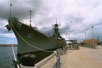
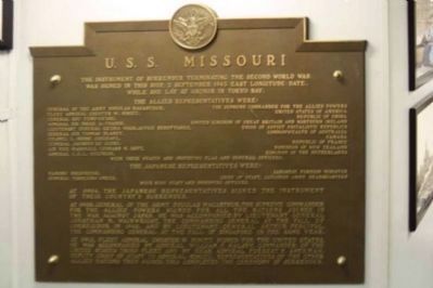
U. S. S. Missouri
Instrument of Surrender, WWII
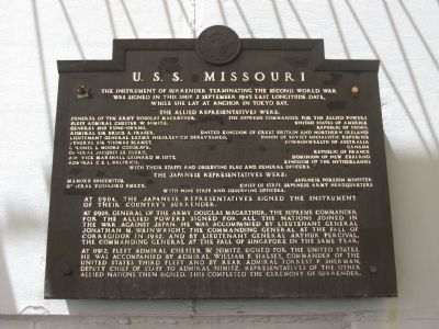
The Allied representatives were • General of the Army Douglas MacArthur, The Supreme Commander for the Allied Powers • Fleet Admiral Chester W. Nimitz, United States of America • General Hsu Yung-Ch’ang, Republic of China • Admiral Sir Bruce A Fraser, United Kingdom of Great Britain and Northern Ireland • Lieutenant General Kuzma Nikilaevich Derevyanko, Union of Soviet Socialistic Republics • General Sir Thomas Blamey, Commonwealth of Australia • Colonel L. Moore Cosgrave, Canada • General Jacques Le Clerc, Republic of France • Air Vice Marshall Leonard M. Isitt, Dominion of New Zealand • Admiral C. E. L. Helfrich, Kingdom of the Netherlands • with their staffs and observing flag and general officers.
The Japanese representatives were • Mamoru Shigemitsu, Japanese Foreign Minister • General Yoshijiro Umezu, Chief of Staff, Japanese Army Headquarters • with nine staff and observing officers.
At 0904, the Japanese representatives signed the instrument of their country’s surrender.
At 0908, General of the Army Douglas MacArthur, the Supreme Commander for the Allied Powers signed for all the nations joined in the war against Japan. He was accompanied by Lieutenant General Jonathan M. Wainwright, the Commanding General at the Fall of Corregidor in 1942, and by Lieutenant General Arthur Percival, the Commanding General at the Fall of Singapore in the same year.
At 0912, Fleet Admiral Chester W. Nimitz signed for the United States. He was accompanied by Admiral William F. Halsey, Commander of the United States Third Fleet and by Rear Admiral Forrest P. Sherman, Deputy Chief of Staff to Admiral Nimitz. Representatives of the other Allied Nations then signed. This completed the ceremony of surrender.
Topics. This historical marker is listed in these topic lists: Military • Peace • War, World II • Waterways & Vessels. A significant historical date for this entry is September 2, 1945.
Location. 21° 21.728′ N, 157° 57.203′ W. Marker is in Pearl Harbor, Hawaii, in Honolulu County. It is in the Naval Station Pearl Harbor. Marker can be reached from Kamehameha Highway (Hawaii Route 99) 0.8 miles south of Ford Island Boulevard. Directions are for the Visitor Center. Marker is located on the surrender deck of the battleship, U.S.S. MISSOURI. A ticket to board the battleship is required. Touch for map. Marker is in this post office area: Jbphh HI 96860, United States of America. Touch for directions.
Other nearby markers. At least 8 other markers are within walking distance of this marker. Fleet Admiral Chester W. Nimitz, USN (within shouting distance of this marker); The Golden Anchor
(about 300 feet away, measured in a direct line); USS West Virginia Memorial (about 500 feet away); U.S. Naval Base Pearl Harbor (approx. ¼ mile away); This Sacred Site (approx. 0.3 miles away); U.S.S. Arizona Memorial (approx. 0.3 miles away); USS Arizona Memorial (approx. 0.3 miles away); U.S.S. Arizona (approx. 0.3 miles away).
Additional keywords. BB-63
Photographed By F. Robby, September 23, 2007
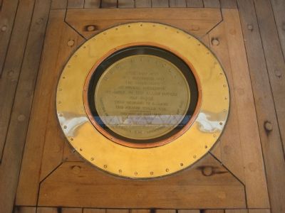
3. Spot of Surrender
This marker is on the floor of the surrender deck. It reads, “U.S.S. Missouri. Over this spot on 2 September 1945 the Instrument of Formal Surrender of Japan to the Allied Powers was signed thus bringingto a close the Second World War. The ship at that time was anchored in Tokyo Bay. Latitude 35° 21′ 17″ North ~ Longitude 139° 45′ 36″ East.”
Photographed By Bill Coughlin, April 26, 2009
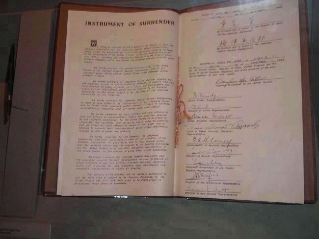
7. Instrument of Surrender
This copy of the Instrument of Surrender that was signed aboard the U. S. S. Missouri is on display at the United States Military Academy at West Point. The pen seen to the left of the document was the first used by Gen. Douglas MacArthur to sign the Japanese surrender.
Credits. This page was last revised on February 10, 2023. It was originally submitted on October 10, 2007, by F. Robby of Baltimore, Maryland. This page has been viewed 6,707 times since then and 75 times this year. Last updated on November 20, 2011, by Richard E. Miller of Oxon Hill, Maryland. Photos: 1. submitted on October 10, 2007, by F. Robby of Baltimore, Maryland. 2. submitted on December 25, 2007, by Mike Stroud of Bluffton, South Carolina. 3, 4. submitted on October 10, 2007, by F. Robby of Baltimore, Maryland. 5. submitted on January 10, 2008, by Kevin W. of Stafford, Virginia. 6. submitted on May 15, 2009, by Mike Stroud of Bluffton, South Carolina. 7. submitted on September 30, 2011, by Bill Coughlin of Woodland Park, New Jersey. • Kevin W. was the editor who published this page.
