East Liverpool in Columbiana County, Ohio — The American Midwest (Great Lakes)
Ohio's Gateway
Photographed by Mike Wintermantel, November 20, 2011
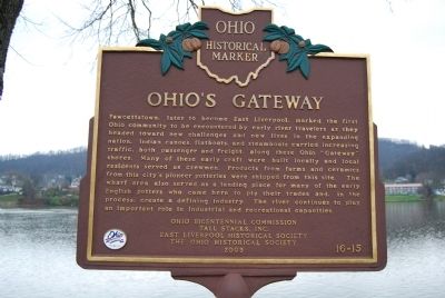
1. Ohio's Gateway Marker
Fawcettstown, later to become East Liverpool, marked the first Ohio community to be encountered by early river travelers as they headed toward new challenges and new lives in the expanding nation. Indian canoes, flatboats, and steamboats carried increasing traffic, both passenger and freight, along these Ohio "Gateway" shores. Many of these early craft were built locally and local residents served as crewmen. Products from farms and ceramics from this city's pioneer potteries were shipped from this site. The wharf area also served as a landing place for many of the early English potters who came here to ply their trades and, in the process, create a defining industry. The river continues to play an important role in industrial and recreational capacities.
Erected 2003 by Ohio Bicentennial Commission, Tall Stacks, Inc., East Liverpool Historical Society, and The Ohio Historical Society. (Marker Number 16-15.)
Topics and series. This historical marker is listed in these topic lists: Settlements & Settlers • Waterways & Vessels. In addition, it is included in the Ohio Historical Society / The Ohio History Connection
this page online
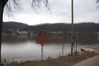
Location. 40° 36.906′ N, 80° 34.526′ W. Marker is in East Liverpool, Ohio, in Columbiana County. It can be reached from Walnut Street. Located at Broadway Wharf on the Ohio River. Touch for map. Marker is in this post office area: East Liverpool OH 43920, United States of America. Touch for directions.

Regionally, this marker is in the Mahoning Valley. It is also in the American Midwest, in the Ohio River Valley, in Appalachia, and specifically in Northern Appalachia. Globally, it is in North America, the Western Hemisphere, the Western World, and the Anglosphere. Historically, it finds itself in what was once the Viceroyalty of New France, the Haudenosaunee (Iroquois) Confederacy, the territory of the Mississippian Culture, and the Northwest Territory.
Other nearby markers. At least 8 other markers are within walking distance of this marker: The Pottery Capital of America (a few steps from this marker); Potters National Bank Building (approx. 0.2 miles away); Central School (approx. 0.2 miles away); Carnegie Public Library (approx. 0.2 miles away); Col. George Washington
Photographed by Mike Wintermantel, November 20, 2011
2. Ohio's Gateway Marker
Also see . . . Remarkable Ohio: The Ohio Historical Marker Program. Ohio History Connection website entry (Submitted on November 20, 2011, by Mike Wintermantel of Pittsburgh, Pennsylvania.)
Credits. This page was last revised on March 12, 2022. It was originally submitted on November 20, 2011, by Mike Wintermantel of Pittsburgh, Pennsylvania. This page has been viewed 925 times since then and 38 times this year. Photos: 1, 2. submitted on November 20, 2011, by Mike Wintermantel of Pittsburgh, Pennsylvania.
