Paris in Fauquier County, Virginia — The American South (Mid-Atlantic)
Mount Bleak Farm
The Settles Anticipate War
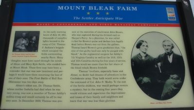
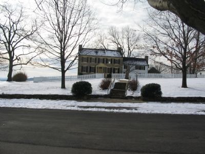
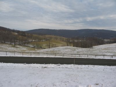
In the early morning hours of July 19, 1861, thousands of campfire lights burned in the camp of Col. Thomas J. Jackson's brigade which occupied the fields surrounding nearby Paris. Many thoughts must have raced through the minds of Abner and Mary Kyle Settle, who resided here at Mount Bleak. Those fires may have been a reminder that war was now imminent and perhaps it would leave them mourning the loss of one of their sons. The First Battle of Bull Run (Manassas) was two days away.
Abner's oldest son, Dr. Thomas Settle, whose mother Isabella had died when he was very young, was now a member of Turner Ashby's militia troop and would certainly be off to war very soon. In December 1859, Thomas was present at the execution of abolitionist John Brown, who was captured during his ill-fated raid on Harper's Ferry. As a physician, he was called to feel for Brown's pulse and declare him legally dead before Brown was cut from the gallows. Thomas heard Brown's grim prediction that, "the sins of this guilty land can only be purged with blood." As the regimental surgeon for Ashby's 7th Virginia Cavalry as well as the 11th, 12th, and 13th Cavalries during his four years of service, Thomas would see more than his fair share of the blood which Brown foretold.
Thomas' brothers, especially Isaac and Abner, no doubt had dreams of adventure in the Confederate army. They both would serve under the command of Col. John S. Mosby. To the rest of the Settle children, war would perhaps remain a mystery; but in the coming four years they would witness and experience the deprivations and losses of their family and neighbors and learn that war was less than glorious.
Erected by Virginia Civil War Trails.
Topics and series. This historical marker is listed in this topic list: War, US Civil. In addition, it is included in the Virginia Civil War Trails series list. A significant historical date for this entry is July 19, 1821.
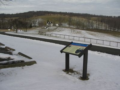
Location. 38° 59.504′ N, 77° 57.947′ W. Marker is in Paris, Virginia, in Fauquier County. Marker is on Edmonds Lane, on the right when traveling west. Located in the main parking lot for Sky Meadows State Park. Touch for map. Marker is in this post office area: Paris VA 20130, United States of America. Touch for directions.
Other nearby markers. At least 8 other markers are within 5 miles of this marker, measured as the crow flies. Jackson’s Bivouac (approx. 1.2 miles away); Clark County / Fauquier County (approx. 1½ miles away); Ashby’s Gap (approx. 1.8 miles away); Mt. Carmel Fight (approx. 2.9 miles away); Lee Moves North Again (approx. 4 miles away); Battle of Upperville
(approx. 4 miles away); Fight at Berry's Ferry (approx. 4.3 miles away); Mary Elizabeth Conover Mellon (approx. 4½ miles away).
More about this marker. On the upper left is a photo of "Dr. Thomas Settle and his first cousin, Amanda Virginia Edmonds." On the right is a portrait of Abner and Mary Kyle Settle.
Also see . . . Sky Meadows. (PDF) National Register documentation for Sky Meadows and Mount Bleak. (Submitted on January 26, 2008, by Craig Swain of Leesburg, Virginia.)
Credits. This page was last revised on June 16, 2016. It was originally submitted on January 26, 2008, by Craig Swain of Leesburg, Virginia. This page has been viewed 2,810 times since then and 48 times this year. Photos: 1, 2, 3, 4. submitted on January 26, 2008, by Craig Swain of Leesburg, Virginia.


