Jersey City in Hudson County, New Jersey — The American Northeast (Mid-Atlantic)
Changes in the Land
Liberty State Park
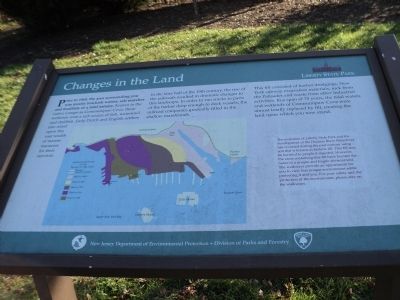
Prior to 1860, the area surrounding you was mostly brackish waters, salt marshes and mudflats of a tidal estuary. Known to the native Lenape as Communipaw Cove, these wetlands were a rich source of fish, waterfowl and shellfish. Early Dutch and English settlers also relied upon this vast wealth of marine resources for their survival.
In the later half of the 19th century, the rise of the railroads resulted in dramatic changes to this landscape. In order to run tracks to parts of the harbor deep enough to dock vessels, the railroad companies gradually filled in the shallow marshlands.
This fill consisted of harbor dredgings, New York subway excavation materials, rock from the Palisades and waste from other industrial activities. In a span of 70 years, the tidal waters and wetlands of Communipaw Cove were almost totally replaced by fill, creating the land upon which you now stand.
The evolution of Liberty State Park and the development of the Hudson River Waterfront has occurred during the past century using soil that is known as historic fill. This fill may be harmful to people if ingested. However, the areas containing this fill have become the home of a unique and fragile environment. The walkways provide an opportunity for you to view this unique environment while protecting it and you. For your safety and the protection of the environment, please stay on the walkways.
Erected by New Jersey Department of Environmental Protection and Division of Parks and Forestry.
Topics. This historical marker is listed in these topic lists: Colonial Era • Natural Features. A significant historical year for this entry is 1860.
Location. 40° 42.576′ N, 74° 3.098′ W. Marker is in Jersey City, New Jersey, in Hudson County. Marker is at the intersection of Audrey Zapp Drive and Phillip Street, on the right when traveling east on Audrey Zapp Drive. Marker is located on the north side of Liberty State Park. Touch for map. Marker is in this post office area: Jersey City NJ 07304, United States of America. Touch for directions.
Other nearby markers. At least 8 other markers are within walking distance of this marker. Communipaw and Lafayette (approx. ¼ mile away); The Bridge of Nations (approx. half a mile away); The Morris Canal (approx. 0.6 miles away); Children's Garden of Van Vorst Park (approx. 0.6 miles away); Franklinia alatamaha (approx. 0.6 miles away); The Van Vorst Park Gardens (approx. 0.6 miles away); Van Vorst Park (approx. 0.6 miles away); a different marker also named Van Vorst Park (approx. 0.6 miles away). Touch for a list and map of all markers in Jersey City.
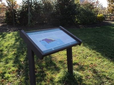
More about this marker. A map of the coastline of the Jersey City waterfront appears on the marker. It shows the original coastline prior to 1860 and how it was expanded over time after a series of landfills.
Credits. This page was last revised on June 16, 2016. It was originally submitted on November 23, 2011, by Bill Coughlin of Woodland Park, New Jersey. This page has been viewed 493 times since then and 26 times this year. Photos: 1, 2, 3. submitted on November 23, 2011, by Bill Coughlin of Woodland Park, New Jersey.


