Douglas Park in Arlington in Arlington County, Virginia — The American South (Mid-Atlantic)
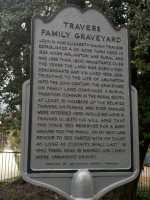
Travers Family Graveyard
Photographed by James Sweetman, November 23, 2011
1. Travers Family Graveyard Marker
Erected by Arlington County, Virginia.
Topics. This historical marker is listed in this topic list: Cemeteries & Burial Sites. A significant historical year for this entry is 1832.
Location. 38° 51.491′ N, 77° 5.563′ W. Marker is in Arlington, Virginia, in Arlington County. It is in Douglas Park. It is at the intersection of South Monroe Street and 13th Street South on South Monroe Street. Touch for map. Marker is
this page online

Regionally, this marker is in the Washington Metropolitan Area and in Northern Virginia. It is also in the American South, specifically in the Upper South, in the Mid-Atlantic, and on the Eastern Seaboard. Globally, it is in the North Atlantic Region, North America, the Western Hemisphere, the Western World, and the Anglosphere. Historically, it finds itself in what was once the territory of the Mississippian Culture, one of the original Thirteen Colonies, one of the Confederate States of America, and the Antebellum South.
Other nearby markers. At least 8 other markers are within walking distance of this marker: Hunter's Crossroads (approx. ¼ mile away); Fort Berry (approx. 0.3 miles away); Arlington Village (approx. 0.4 miles away); Mt. Zion Baptist Church (approx. 0.4 miles away); Alcova (approx. 0.4 miles away); Dr. Roland Herman Bruner (approx. half a mile away); Echo (approx. 0.6 miles away); Our Lady Queen of Peace (approx. 0.6 miles away). Touch for a list and map of all markers in Arlington.
Photographed by J. Makali Bruton, September 2, 2015
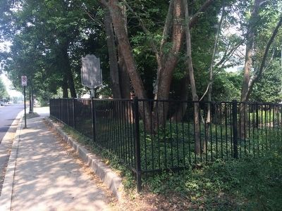
2. Travers Family Graveyard Marker
Photographed by J. Makali Bruton, September 2, 2015
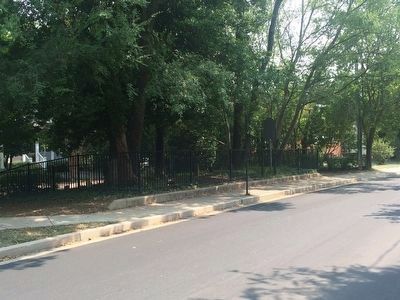
3. Travers Family Graveyard Marker
The marker is to the right in this wide view of the cemetery.
Credits. This page was last revised on February 1, 2023. It was originally submitted on November 24, 2011, by James Sweetman of Arlington, Virginia. This page has been viewed 1,504 times since then and 45 times this year. Photos: 1. submitted on November 24, 2011, by James Sweetman of Arlington, Virginia. 2, 3. submitted on September 4, 2015, by J. Makali Bruton of Washington, District of Columbia. • Bernard Fisher was the editor who published this page.
