Near Sarah Ann in Logan County, West Virginia — The American South (Appalachia)
Hatfield Cemetery
Photographed by Forest McDermott, April 20, 2008
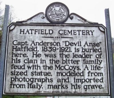
1. Hatfield Cemetery Marker
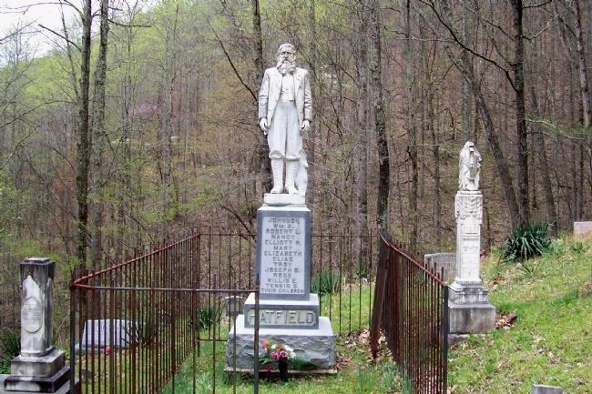
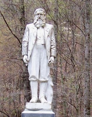
Capt. Anderson "Devil Anse" Hatfield, 1839-1921, is buried here. He was the leader of his clan in the bitter family feud with the McCoys. A life-sized statue, modeled from photographs and imported from Italy, marks his grave.
Erected 1963 by West Virginia Historic Commission.
Topics and series. This historical marker is listed in these topic lists: Arts, Letters, Music • Cemeteries & Burial Sites. In addition, it is included in the The Hatfield-McCoy Feud, and the West Virginia Archives and History series lists.
Location. 37° 42.225′ N, 81° 59.458′ W. Marker is near Sarah Ann, West Virginia, in Logan County. It is on Jerry West Highway (West Virginia Route 44), on the right when traveling south. In front of the bridge leading to the Hatfield Cemetery. Touch for map. Marker is at or near this postal address: 12560 Jerry West Highway, Sarah Ann WV 25644, United States
this page online

Regionally, this marker is in the Southern Coalfields. It is also in the American South, specifically in the Upper South, in Appalachia, and specifically in Southern Appalachia. Globally, it is in North America, the Western Hemisphere, the Western World, and the Anglosphere. Historically, it finds itself in what was once the territory of the Mississippian Culture.
Other nearby markers. At least 8 other markers are within walking distance of this marker: The Family (about 500 feet away, measured in a direct line); The Resting Place (about 500 feet away); The Feud (about 700 feet away); The Man: "Devil Anse" Hatfield (about 800 feet away); The Land (approx. 0.2 miles away); Hatfield Family Well (approx. ¼ mile away); Devil Anse Hatfield's Homeplace (approx. ¼ mile away); Devil Anse Hatfield's Homeplace Bridge (approx. ¼ mile away). Touch for a list and map of all markers in Sarah Ann.
Related markers.
Via Timalderman, unknown
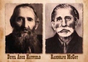
2. FEUD FACTS: The Real Story Of The Hatfields & McCoys
Tim Alderman blog entry
Click for more information.
Click for more information.
Additional commentary.
1. Visiting Hatfield Cemetery
Persons wishing to visit the cemetery itself should know that it is a trek to get there.
The trail shown currently on Google Maps, leading from the "Hatfield Cemetery" marker, will get you there, but it is steep and tricky to climb when it is wet.
A new trail (not yet shown in Google maps) has been constructed a short distance south which offers an easier climb to the cemetery with paved gravel, and contains several new markers. There is also more and easier parking available.
Regardless of which trail is taken, the last climb up to the cemetery is quite steep.
— Submitted July 23, 2026, by Mark Parker of Hickory, North Carolina.
Photographed by Forest McDermott, April 20, 2008
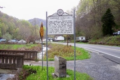
3. Hatfield Cemetery Marker
Photo taken looking north on Route 44, below marker is a stone base with plaque designating the cemetery a National Registered Historic Place. The bridge to the left leads to the cemetery up the hill, difficult to see from the marker.
Photographed by Robert Heyward, October 2021
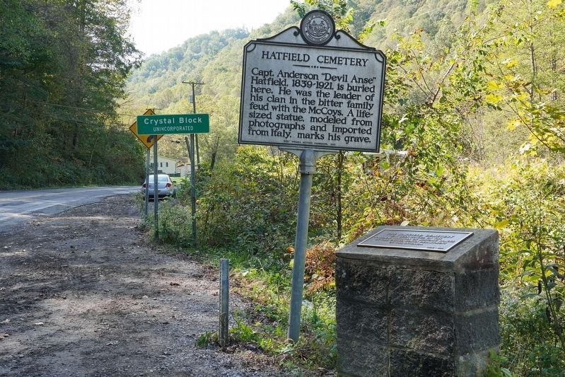
4. Hatfield Cemetery Marker
Located beside the street near the entrance of the Hatfield Family Cemetery.
Photographed by Forest McDermott, May 20, 2008
5. Hatfield Cemetery Grave Stone "Devil Anse" Hatfield
The names of Hatfield's children are craved in the stone below the statue of Capt. Anderson "Devil Anse" Hatfield.
Photographed by Forest McDermott, May 20, 2008
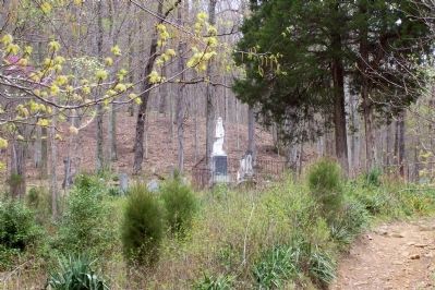
6. Hatfield Cemetery from a Distance
Photo taken of the cemetery about half way between the marker and the grave site. Cemetery lies up a hill from the road.
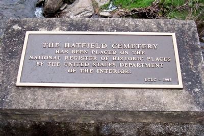
Photographed by Forest McDermott, May 20, 2008
7. Hatfield Cemetery Designated National Registered Historic Place
Photographed by Forest McDermott, May 20, 2008
8. Anderson Hatfield (1838–1921)
Devil Anse ordered this marble statue from Italy and had it hauled here by mules before he died.
Old Photo Archive, 1897
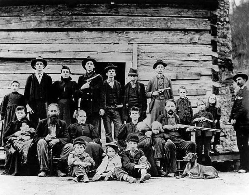
9. The Hatfield Clan in 1897
The Hatfield and McCoy feud is one of the nation's most storied family/state conflicts, lasting over 30-years and being the source of numerous conflicts that impacted trade and travel between West Virginia and Kentucky. This 1897 photo captures the entire Hatfield family a few years after they had officially ended the feud.

Photographed by Mark Parker, July 11, 2026
10. Hatfield Cemetery arch at the nearby trail from the marker
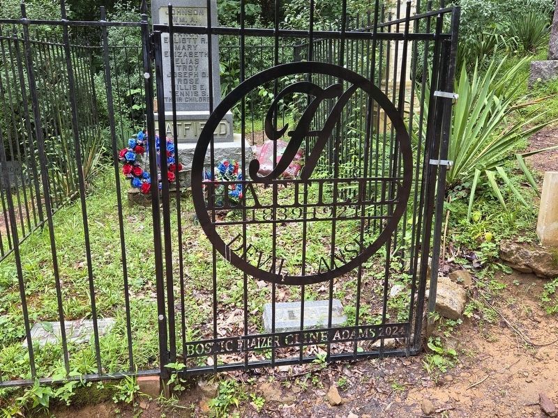
Photographed by Mark Parker, July 11, 2026
11. Gate to enter the gravesite of Devil Anse Hatfield
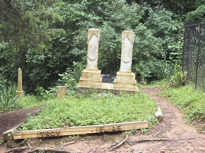
Photographed by Mark Parker, July 11, 2026
12. Gravesites of Troy and Ellis Hatfield both killed in a gunfight on October 17, 1911
Credits. This page was last revised on August 4, 2026. It was originally submitted on November 27, 2011, by Forest McDermott of Masontown, Pennsylvania. This page has been viewed 20,460 times since then and 125 times this year. Photos: 1. submitted on November 27, 2011, by Forest McDermott of Masontown, Pennsylvania. 2. submitted on April 11, 2022, by Larry Gertner of New York, New York. 3. submitted on November 27, 2011, by Forest McDermott of Masontown, Pennsylvania. 4. submitted on December 31, 2021, by Robert Heyward of Prattville, Alabama. 5, 6, 7, 8. submitted on November 27, 2011, by Forest McDermott of Masontown, Pennsylvania. 9. submitted on September 25, 2016. 10, 11, 12. submitted on July 23, 2026, by Mark Parker of Hickory, North Carolina. • Bill Pfingsten was the editor who published this page.
