Near Lee Vining in Mono County, California — The American West (Pacific Coastal)
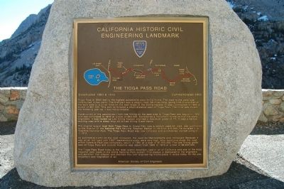
The Tioga Pass Road
Constructed 1883 & 1910 - Commemorated 2002
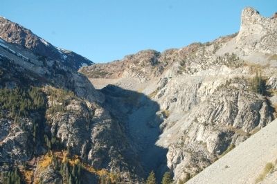
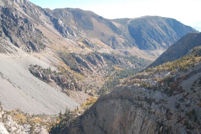
Construction of the second part from Lee Vining on the east side to Tioga Pass was begun in 1902 and was completed in 1910 at a cost of $63,000. Considered a monument to the skill of the state engineers, it was routed up Lee Vining Canyon and has a maximum grade of 7%. It was a narrow, exciting road with a steep drop off to Lee Vining Creek below.
The original wagon road from Tioga Pass to Crane Flat, now a seldom used toll road, was purchased by the director of the National Park Service, Stephen Mather in 1915 for $15,000. He donated it to Yosemite National Park. The Tioga Pass Road was now complete and automobiles started using it in 1915.
As automobile traffic on the road increased, the need for improvements also increased. Because it was an all dirt road until 1937, maintenance costs were very high. After extensive study the road within Yosemite Park was completely rebuilt in 1961 at a cost of $7,000,000. The Lee Vining grade east of Tioga Pass and outside Yosemite was rebuilt from 1965 to 1970 at a cost of $6,600,000.
The Tioga Pass Road today is the most scenic mountain road in all of California and one of the most beautiful park roads in the entire National Park system. This plaque is dedicated to the engineers and workmen that created and maintain this civil engineering masterpiece. It exists today for the use, enjoyment and inspiration of all.
Erected 2002 by American Society of Civil Engineers.
Topics and series. This historical marker is listed in this topic list: Roads & Vehicles. In addition, it is included in the ASCE Civil Engineering Landmarks series list.
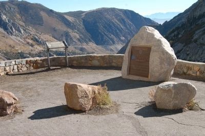
Location. 37° 56.512′ N, 119° 13.752′ W. Marker is near Lee Vining, California, in Mono County. Marker is on Tioga Pass Road (State Highway 120), on the right when traveling east. This marker is 6 miles east of Lee Vining and 2 miles west of the Yosemite National Park entrance. Touch for map. Marker is in this post office area: Lee Vining CA 93541, United States of America. Touch for directions.
Other nearby markers. At least 8 other markers are within 7 miles of this marker, measured as the crow flies. Would-Be Miners and Occasional Tourists (here, next to this marker); Bennettville (approx. 1.2 miles away); a different marker also named Tioga Pass Road
(approx. 2.7 miles away); Yosemite Ghost Mines (approx. 4 miles away); Sheriff James P. Dolan (approx. 5.7 miles away); Lundy (approx. 6 miles away); Lee Vining (approx. 6.1 miles away); Upside-Down House (approx. 6.1 miles away). Touch for a list and map of all markers in Lee Vining.
Regarding The Tioga Pass Road. Tioga Pass is a seasonal state highway and is subject to winter closing. The highway has been designated as a California Historic Civil Engineering Landmark.
Credits. This page was last revised on June 16, 2016. It was originally submitted on November 29, 2011, by Barry Swackhamer of Brentwood, California. This page has been viewed 1,276 times since then and 59 times this year. Photos: 1, 2, 3, 4. submitted on November 29, 2011, by Barry Swackhamer of Brentwood, California. • Syd Whittle was the editor who published this page.


