Near Lee Vining in Mono County, California — The American West (Pacific Coastal)
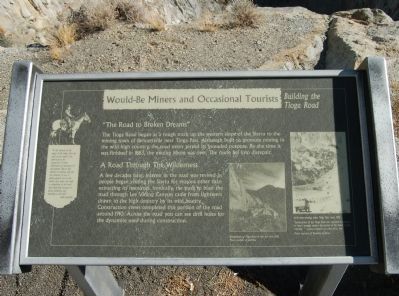
Would-Be Miners and Occasional Tourists
Building the Tioga Road
Inscription.
“The Road to Broken Dreams”
The Tioga Road began as a rough track up the western slope of the Sierra to the mining town of Bennettville near Tioga Pass. Although built to promote mining in the wild high country, the road never served its intended purpose. By the time it was finished in 1883, the mining boom was over. The route fell into disrepair.
A Road Through the Wilderness
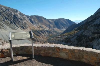
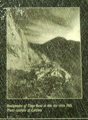
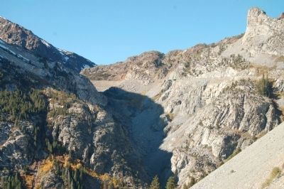
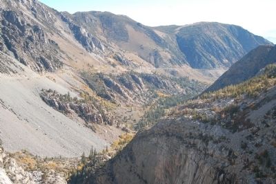
A few decades later, interest in the road was revived as people began visiting the Sierra for reason other than extracting resources. Ironically, the push to blast the road through Lee Vining Canyon came from sightseers drawn to the high country by its wild beauty. Construction crews completed this portion of the road around 1910. Across the road you can see drill holes for the dynamite used during construction.
[Side bar on left]:
“To the laborer in the sweat of his labor, the raw stuff on his anvil is an adversary to be conquered. So was the wilderness an adversary of the pioneer. But to the laborer in repose, able for the moment to cast a philosophical eye on his world, that same raw stuff is something to be loved and cherished, because it gives definition and meaning to his life.” Aldo Leopold
Topics. This historical marker is listed in this topic list: Roads & Vehicles. A significant historical year for this entry is 1883.
Location. 37° 56.51′ N, 119° 13.75′ W. Marker is near Lee Vining, California, in Mono County. Marker is on Tioga Pass Road (California Route 120). The maker is 6 miles west of Lee Vining and 2 miles east of the Yosemite National Park Entrance on Tioga Pass Road. Touch for map. Marker is in this post office area: Lee Vining CA 93541, United States of America. Touch for directions.
Other nearby markers. At least 8 other markers are within 7 miles of this marker, measured as the crow flies. The Tioga Pass Road (here, next to this marker); Bennettville (approx. 1.2 miles away); a different marker also named Tioga Pass Road (approx. 2.7 miles away); Yosemite Ghost Mines (approx. 4 miles away); Sheriff James P. Dolan (approx. 5.7 miles away); Lundy (approx. 6 miles away); Lee Vining (approx. 6.1 miles away); Upside-Down House (approx. 6.1 miles away). Touch for a list and map of all markers in Lee Vining.
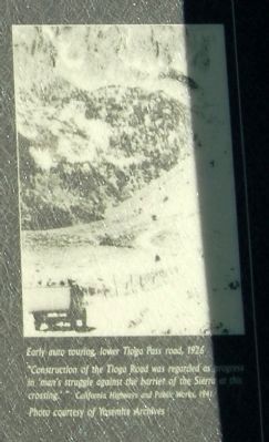
Yosemite Archives, circa 1926
4. Close-Up of Photo Displayed on Marker
Early auto touring, lower Tioga Pass, 1926.
“Construction of the Tioga Road was regarded as progress in ‘man’s struggle against the barrier of the Sierra at this crossing.’” California Highway and Public Works, 1941.
Photo courtesy of Yosemite Archives.
“Construction of the Tioga Road was regarded as progress in ‘man’s struggle against the barrier of the Sierra at this crossing.’” California Highway and Public Works, 1941.
Photo courtesy of Yosemite Archives.
Credits. This page was last revised on June 16, 2016. It was originally submitted on November 29, 2011, by Barry Swackhamer of Brentwood, California. This page has been viewed 623 times since then and 14 times this year. Photos: 1, 2, 3, 4, 5, 6. submitted on November 29, 2011, by Barry Swackhamer of Brentwood, California. • Syd Whittle was the editor who published this page.
