West Pike Run Township near Centerville in Washington County, Pennsylvania — The American Northeast (Mid-Atlantic)
Madonna of the Trail
Photographed by J. J. Prats, August 27, 2006
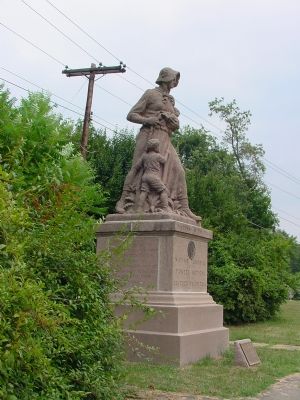
1. Madonna of the Trail Marker
(South Face) N.S.D.A.R. Memorial to the Pioneer Mothers of the Covered Wagon Days.
(East Face) On this historic spot, the hunting ground of the friendly Indian Nemacolin, this monument is erected and dedicated to the memory of our pioneer mothers.
(North Face) The National Old Trails Road.
(West Face) Erected in Nineteen Hundred Twenty Eight in Washington County, Pennsylvania, the oldest county west of the Allegheny Mountains. Named for the father of our country.
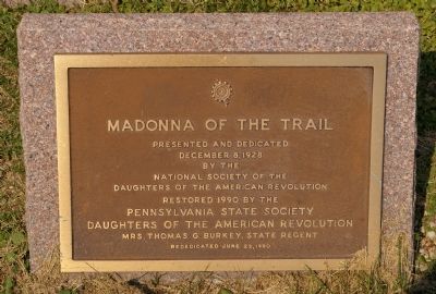
(Small brass plaque in front of monument) Madonna of the Trail. Presented and dedicated December 8, 1928 by the National Society of the American Revolution. Restored 1990 by the Pennsylvania State Society, Daughters of the American Revolution, Mrs. Thomas G. Burkey, State Regent. Rededicated June 23, 1990.
Erected 1928 by the National Society of the Daughters of the American Revolution. (Marker Number 10.)
Topics and series. This historical marker is listed in these topic lists: Roads & Vehicles • Settlements & Settlers. In addition, it is included in the Daughters of the American Revolution (DAR), the Madonnas of the Trail, and
this page online
Location. 40° 3.622′ N, 80° 0.775′ W. Marker is near Centerville, Pennsylvania, in Washington County. It is in West Pike Run Township. It is at the intersection of Main Street (U.S. 40) and the Nemacolin Country Club driveway, on the right when traveling west on Main Street. Touch for map. Marker is at or near this postal address: 3015 Main St, Daisytown PA 15427, United States of America. Touch for directions.

Regionally, this marker is in Greater Pittsburgh. It is also in the American Northeast, in the Mid-Atlantic, in Appalachia, and specifically in Northern Appalachia. Globally, it is in North America, the Western Hemisphere, the Western World, and the Anglosphere. Historically, it finds itself in what was once the Haudenosaunee (Iroquois) Confederacy and also one of the original Thirteen Colonies.
Other nearby markers. At least 5 other markers are within walking distance of this marker: Revolutionary War Soldiers (approx. 0.6 miles away); 2850 Main Street (approx. 0.7 miles away); Historic National Hotel (approx. 0.7 miles away);
Photographed by J. J. Prats, August 27, 2006
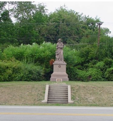
2. View from Country Club Driveway Across the Road
More about this marker. Blink and you'll miss it. The road is straight here, and trees come up to the edge of the road in places. You can't see it in the distance. Look for the Nemacolin Country Club entrance instead.
Related markers. Click here for a list of markers that are related to this marker. This is the third marker on the route west, in West Virginia.
Also see . . . Madonna of the Trail. Pioneer Monuments in the American West website entry (Submitted on July 10, 2022, by Larry Gertner of New York, New York.)
Photographed by Christopher Busta-Peck, September 22, 2007
3. Rededication plaque

Photographed by Allen C. Browne, May 26, 2005
4. Inscription
The Hunting Ground
Of The Friendly Indian
Nemacolin
This Monument
Is Erected And Dedicated
To The Memory Of Our
Pioneer Mothers
“The events of this inscription precede the defeat of Braddock. In 1749 the Ohio Company, also known as The Ohio Company of Virginia, was chartered. Made up of wealthy Virginian planters, speculators and London merchants, this organization was granted 200,000 acres of land in West Virginia by King George II. In 1753 King George granted them an additional 350,000 acres. The purpose of this project was to colonize the Ohio Valley. However, because of the French and Indian War, this venture at this time was a failure but the efforts made to implement its objectives changed the course of history.
One of its first endeavors was to engage Colonel Thomas Cresap of Old Town, Maryland to blaze a trail from Will's Creek over the Allegheny Mountains to what is now Pittsburgh. Colonel Cresap persuaded the elderly Delaware Indian Chief Nemacolin to go with him and point out the way.
Colonel Cresap did not build the road -just indicated it by marking the trees and leaving stone piles as reminders. He named this route ‘Nemacolin's Path.’ It was to become a well known and much traveled road.” — Fern Iola Bauer.
Photographed by Allen C. Browne, May 26, 2005
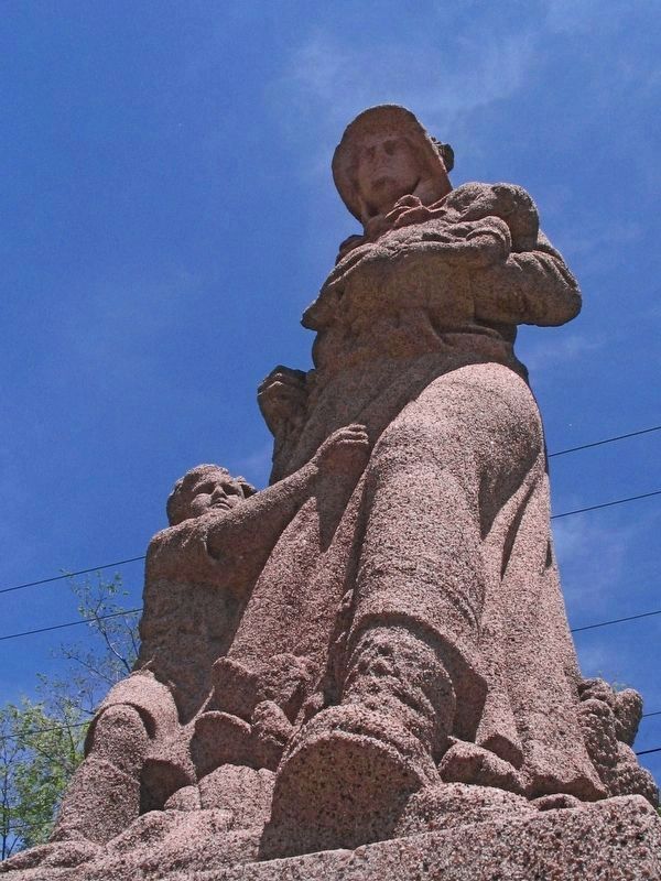
5. Madonna of the Trail
August Liembach cast 12 of these pioneer woman statues under the direction of Arlene B. Nichols Moss. They were set out along the National Old Trails Road in 1928, one in each state the road passed through.
Photographed by Allen C. Browne, May 26, 2005
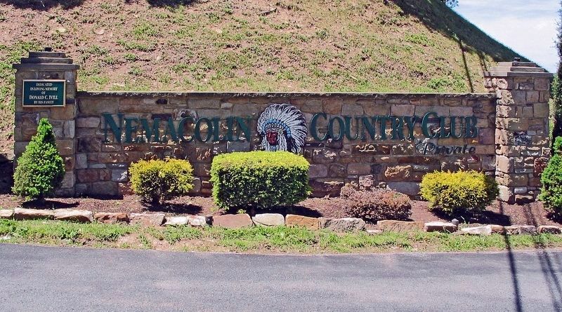
6. Nemocolin Country Club
Credits. This page was last revised on February 7, 2023. It was originally submitted on August 30, 2006, by J. J. Prats of Powell, Ohio. This page has been viewed 2,951 times since then and 77 times this year. Photos: 1, 2. submitted on August 30, 2006, by J. J. Prats of Powell, Ohio. 3. submitted on January 25, 2008, by Christopher Busta-Peck of Shaker Heights, Ohio. 4, 5, 6. submitted on July 2, 2017, by Allen C. Browne of Silver Spring, Maryland.
