Near Pleasanton in Linn County, Kansas — The American Midwest (Upper Plains)
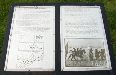
Two Mounted Armies Collide
Captain Richard Hinton was with the Union soldiers as they approached from the north. As the "timber of Mine Creek" came into view, Hinton wrote,
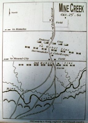
the enemy were discovered in great force formed in line of battle upon the north side of the stream....From our front to the rebel lines, the ground formed a gentle descent. On the right, and a little to our front, was a farm house and fences. To our extreme left and front was a slight swale, the timber and the creek, then a rising corn field with a log cabin at the top.
In this vicinity Colonel John F. Philips prepared his brigade of Missouri State Militia for the attack. To the left was Colonel Benteen, commanding a brigade of Iowa, Missouri, and Indiana cavalry regiments. The Union forces were made up of about two thousand five hundred well-armed soldiers. Having won a victory a couple of days before at the Battle of Westport, there men were battle-hardened and confident.
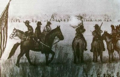
At about 11 o'clock in the morning the mounted Union forces closed on the rebel line and hit them with a "furious charge." With sabers drawn, Philips' troops were the first to slam into the Confederate left flank. Philips wrote, "the fighting became general and terrific. The impetuosity of the onset surprised and confounded the enemy. He trembled and wavered and the wild shouts of our soldiers rising above the din of battle told that he gave way."
The initial charge of Benteen's Tenth Missouri on Marmaduke's position stalled. However, Major A. R. Pierce and the Fourth Iowa "struck the enemy's line like a thunderbolt." The Fourth Iowa pierced the Confederate line then turned back and rolled up the rebel defensive position.
"Being mostly a prairie country the troops of both armies were in full view," reported Major General Samuel R. Curtis.
and the rapid onward movement of the whole force presented the most extensive, beautiful, and animated view of hostile armies I have ever witnessed. Spread over vast prairies, some moving at full speed in column, some in double lines, and others as skirmishers, groups striving in utmost efforts, and shifting as occasion required, while the great clouds of living masses moved steadily southward, presented a picture of prairie scenery such as neither man nor pencil can delineate.
The battle that occurred when these two mounted armies collided was brief, lasting only thirty minutes, but bloody. Colonel Charles W. Blair, Fourteenth Kansas Cavalry, described the engagement as "A rush, a scramble, and all was over." Colonel Philips wrote, "The scene of death was as terrible as the victory was speedy and glorious." The colonel's Union soldiers lost only eight dead and less than one hundred
wounded. The routed Confederates suffered terribly: well over one thousand soldiers were dead, wounded, or captured. At least three hundred killed or badly wounded horses littered the battlefield.
Erected by Kansas Historical Society. (Marker Number Stop F.)
Topics. This historical marker is listed in these topic lists: Animals • War, US Civil.
Location. 38° 8.684′ N, 94° 43.387′ W. Marker is near Pleasanton, Kansas, in Linn County. Marker is on the grounds of Mine Creek Battlefield State Historic Site, off 850th Road (Kansas Route 52), about one mile west of US Highway 69. Touch for map. Marker is in this post office area: Pleasanton KS 66075, United States of America. Touch for directions.
Other nearby markers. At least 8 other markers are within walking distance of this marker. The Fort Scott Road (here, next to this marker); The Battle Begins (a few steps from this marker); Confederate Defeat (a few steps from this marker); After the Battle (a few steps from this marker); Battle of Mine Creek (within shouting distance of this marker); Mine Creek Battlefield Aerial Overlay (within shouting distance of this marker); Combat at State Line (within shouting distance of this marker); Union Charge (within shouting distance of this marker). Touch for a list and map of all markers in Pleasanton.
More about this marker. This marker was replaced in 2012 with a series of new markers.
Also see . . .
1. Battle of Mine Creek, Kansas. Kansapedia website entry (Submitted on December 4, 2011, by William Fischer, Jr. of Scranton, Pennsylvania.)
2. Mine Creek Civil War Battlefield. Kansas Historical Society website entry (Submitted on January 16, 2022, by Larry Gertner of New York, New York.)
Credits. This page was last revised on January 16, 2022. It was originally submitted on December 4, 2011, by William Fischer, Jr. of Scranton, Pennsylvania. This page has been viewed 655 times since then and 15 times this year. Photos: 1, 2, 3, 4. submitted on December 4, 2011, by William Fischer, Jr. of Scranton, Pennsylvania.


