Golden in Jefferson County, Colorado — The American Mountains (Southwest)
Horace Greeley’s Crossing Point
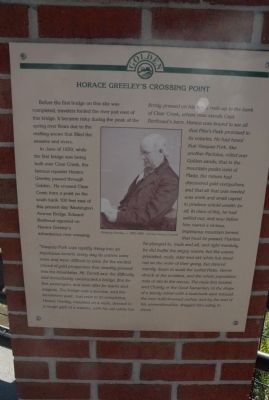
In June of 1859, while the first bridge was being built over Clear Creek, the famous reporter Horace Greeley passed through Golden. He crossed Clear Creek from a point on the south bank 100 feet east of this present-day Washington Avenue Bridge. Edward Berthoud reported on Horace Greeley’s adventurous river crossing:
"Vasquez Fork was rapidly rising into an impetuous torrent; every day its waters were more and more difficult to pass, for the excited crowd of gold prospectors that steadily pressed into the mountains. Mr. Ferrell saw the difficulty and immediately constructed a bridge, first for foot passengers, and soon after for teams and wagons. The bridge was a success, and the investment paid. Just prior to its completion, Horace Greeley, mounted on a mule, dressed in a rough garb of a traveler, with his old white hat firmly pressed on his head, rode up to the bank of Clear Creek, where now stands Capt. Berthoud’s barn. Horace was bound to see all that Pike’s Peak promised to its votaries. He had heard that Vasquez Fork, like another Pactolus, rolled over Golden sands; that in the mountain peaks west of Platte, the miners had discovered gold everywhere, and that all that was needed was work and small capital to produce untold wealth for all. In view of this, he had sallied out; and now before him roared a vicious, impetuous mountain torrent, that must be passed. Fearless he plunged in, mule and all, and right manfully he did buffet the angry waves; but the waves prevailed; mule, rider and old white hat stood not on the order of their going, but danced merrily down to swell the turbid Platte. Horror struck at the accident, and the whole population rode or rant to the rescue. The mule first landed, and Charity or the Good Samaritan, in the shape of a sturdy miner with a boat-hook soon rescued the now half-drowned author, and by the seat of his unmentionables, dragged him safely to shore."
Topics. This historical marker is listed in these topic lists: Bridges & Viaducts • Exploration • Settlements & Settlers • Waterways & Vessels. A significant historical month for this entry is June 1859.
Location. 39° 45.411′ N, 105° 13.329′ W. Marker is in Golden, Colorado, in Jefferson County. Marker can be reached from Washington Avenue. The marker is located on the south side of Clear Creek, on the trail a few yards east of the Washington Street Bridge. Touch for map. Marker is at or near this postal address: 1027 Washington Avenue, Golden CO 80401, United States of America. Touch for directions.
Other nearby markers. At least
8 other markers are within walking distance of this marker. Greeley’s Crossing (here, next to this marker); Winter Wind on the Mesa (a few steps from this marker); Ferrell/Berthoud Home (Miners Hotel) (a few steps from this marker); Bridge Load Ordinance Background (a few steps from this marker); 922 Washington Avenue (within shouting distance of this marker); Native Americans on Clear Creek (within shouting distance of this marker); The White Ash Mine Disaster (within shouting distance of this marker); Clear Creek (within shouting distance of this marker). Touch for a list and map of all markers in Golden.
Credits. This page was last revised on November 8, 2019. It was originally submitted on December 4, 2011, by Charles T. Harrell of Woodford, Virginia. This page has been viewed 1,064 times since then and 41 times this year. Photos: 1. submitted on December 4, 2011, by Charles T. Harrell of Woodford, Virginia. 2. submitted on August 14, 2018, by Allen C. Browne of Silver Spring, Maryland. • Syd Whittle was the editor who published this page.
Editor’s want-list for this marker. Wide area view of the marker and its surroundings. • Can you help?

