Moores Mill in Atlanta in Fulton County, Georgia — The American South (South Atlantic)
Montgomery-DeFoor House Site
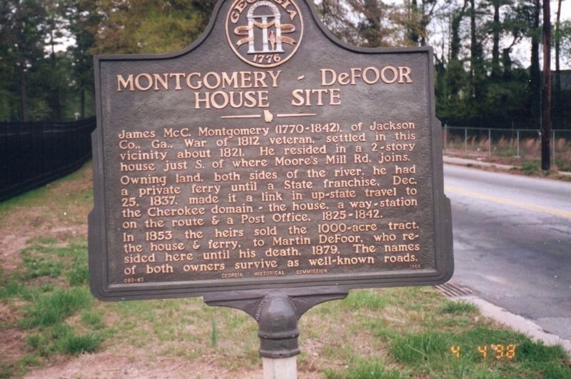
Photographed by William "Bill" Bruce, April 4, 1998
1. Montgomery-DeFoor House Site Marker
Owning land, both sides of the river, he had a private ferry until a State franchise, Dec. 25, 1837, made it a link in up-state travel to the Cherokee domain -- the house, a way-station on the route & a Post Office, 1825 - 1842.
In 1853 the heirs sold the 1000-acre tract, the house & ferry, to Martin DeFoor, who resided here until his death, 1879. The names of both owners survive as well-known roads.
Erected 1956 by Georgia Historical Commission. (Marker Number 060-63.)
Topics and series. This historical marker is listed in this topic list: Settlements & Settlers. In addition, it is included in the Georgia Historical Society series list. A significant historical date for this entry is December 25, 1900.
Location. Marker has been reported missing. It was located near 33° 49.245′ N, 84° 27.067′ W. Marker was in Atlanta, Georgia, in Fulton County. It was in Moores Mill. It was at the intersection of Moore's Mill Road and Bolton Road, on the
this page online

Regionally, this marker was in the Piedmont. It was also in the American South and specifically in the Deep South. Globally, it was in North America, the Western Hemisphere, the Western World, and the Anglosphere. Historically, it found itself in what was once the territory of the Mississippian Culture, one of the original Thirteen Colonies, one of the Confederate States of America, and the Antebellum South.
Other nearby markers. At least 8 other markers are within walking distance of this location: Montgomery Cemetery (about 500 feet away, measured in a direct line); Johnston’s Army Crossed the River (approx. half a mile away); Standing Peach Tree (approx. half a mile away); Fort Peach Tree (approx. half a mile away); Montgomery's Ferry (approx. half a mile away); Battle at Moore’s Mill (approx. 0.6 miles away); Moore's Mill (approx. 0.6 miles away); Fort Peachtree, War of 1812 (approx. ¾ mile away). Touch for a list and map of all markers in Atlanta.
More about this marker.
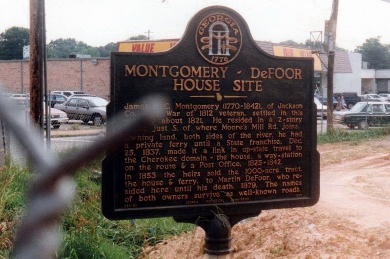
Photographed by Tim Fillmon, circa 1993
2. Montgomery-DeFoor House Site Marker

Photographed by David Seibert, December 14, 2011
3. Montgomery-DeFoor House Site Marker Post

Photographed by David Seibert, December 14, 2011
4. Montgomery-DeFoor House Site Marker Post
Moore's Mill Road is in the foreground, and Bolton Road to the left.
Credits. This page was last revised on August 12, 2025. It was originally submitted on December 15, 2011, by David Seibert of Sandy Springs, Georgia. This page has been viewed 5,100 times since then and 110 times this year. Photos: 1. submitted on August 11, 2025, by Hannah Elizabeth Maloney-Johnston of Marietta, Georgia. 2. submitted on October 6, 2020, by Tim Fillmon of Webster, Florida. 3, 4. submitted on December 15, 2011, by David Seibert of Sandy Springs, Georgia. • Craig Swain was the editor who published this page.
