Near Pridgen in Coffee County, Georgia — The American South (South Atlantic)
Old Coffee Road
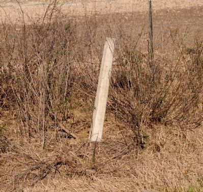
Photographed by David Seibert, January 27, 2008
1. Old Coffee Road Marker Post
Erected by Georgia Historical Commission. (Marker Number 034-2.)
Topics and series. This historical marker is listed in this topic list: Roads & Vehicles. In addition, it is included in the Georgia Historical Society series list. A significant historical year for this entry is 1823.
Location. Marker has been reported missing. It was located near 31° 45.744′ N, 82° 59.664′ W. Marker was near Pridgen, Georgia, in Coffee County. It was at the intersection of U.S. 319 and County Route 321, on the right when traveling west on U.S. 319. Touch for map.
this page online

Regionally, this marker was on the Coastal Plain. It was also in the American South, specifically in the Deep South, and in the Wiregrass. Globally, it was in North America, the Western Hemisphere, the Western World, and the Anglosphere. Historically, it found itself in what was once the territory of the Mississippian Culture, one of the original Thirteen Colonies, one of the Confederate States of America, and the Antebellum South.
Other nearby markers. At least 4 other markers are within 9 miles of this location, measured as the crow flies: Old Courthouse Location (approx. 3.6 miles away); Jacksonville (approx. 3.6 miles away); Cullen Boney Descendants (approx. 8.2 miles away); World Record Bass (approx. 8.7 miles away).
More about this marker. The text for the missing marker was taken from “Georgia Historical Markers” (Bay Tree Grove, Second Edition 1978) compiled by Carroll P. Scruggs from the records of the Georgia Historical Commission.
Credits. This page was last revised on June 16, 2016. It was originally submitted on December 15, 2011, by David Seibert of Sandy Springs, Georgia. This page has been viewed 700 times since then and 34 times this year. Photo 1. submitted on December 15, 2011, by David Seibert of Sandy Springs, Georgia. • Craig Swain was the editor who published this page.
Editor’s want-list for this marker. Photo of marker prior to disappearance. • Can you help?
