Shawnee in Johnson County, Kansas — The American Midwest (Upper Plains)
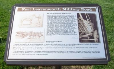
Fort Leavenworth Military Road
The Fort Leavenworth Military Road
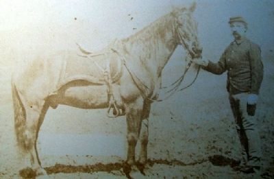
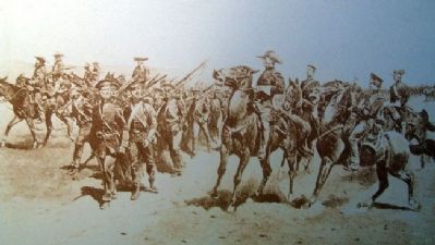
Created in 1837, this road was originally created to run from Fort Leavenworth south to Fort Gibson in Oklahoma. It was actually part of the route that Congress had designated as the border line of the "permanent Indian Frontier", which ran as far north as Fort Snelling in Minnesota and as far south as Fort Towson in Oklahoma. By 1842 Fort Scott was built, and infantry and dragoon troops moved regularly on this military road between it and Fort Leavenworth over the next several decades. The Fort Leavenworth Military Road was the route, by way of the Gum Springs cut-off through modern day Shawnee and Lenexa, that soldiers from the fort used to reach the Santa Fe trail in Johnson County. In the 1830's military escorts for the Santa Fe traders' caravans came this way, and the road carried soldiers destined for the Mexican War in 1846-1848. The old road faded from memory after the Civil War, but for over thirty years it was an important route for the frontier military and other travelers.
KCAHTA 2005
Private Benjamin Wiley
July 7, 1847
"This day at 2 o'clock P.M. all was completed and Co. B marched out five miles on the military road where we found the other two companies who had gone out before us, and camped for the night near a good spring and plenty of stock water."
After leaving Fort Leavenworth as described above, and then moving south to the Gum Springs area, Wiley described from Gum Springs south to the Santa Fe Trail...
"This morning got an early start & marched 12 miles camped on a beautiful plain on the banks of a fine clear stream of water, with plenty of wood near at hand. This day we saw several volunteers returning home who had gone out under General Kearney last summer. They did not look like "men in Buchram", but real "Rough and Readys."
Erected 2006 by City of Shawnee and State Historical Society of Missouri.
Topics. This historical marker is listed in these topic lists: Industry & Commerce • Roads & Vehicles • Settlements & Settlers • War, Mexican-American. A significant historical month for this entry is July 1856.
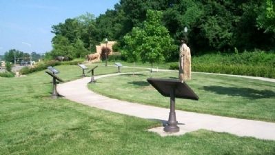
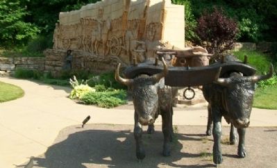
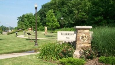
Location. 39° 0.864′ N, 94° 42.415′ W. Marker is in Shawnee, Kansas, in Johnson County. Marker is on Shawnee Mission Parkway near Melrose Lane, on the right when traveling east. Marker is in Pioneer Crossing Park. Touch for map. Marker is at or near this postal address: 10401 Shawnee Mission Parkway, Shawnee KS 66203, United States of America. Touch for directions.
Other nearby markers. At least 8 other markers are within walking distance of this marker. California Road (here, next to this marker); The Development of the Kansas City area Frontier Trails Network (here, next to this marker); Wagonmaster's House (here, next to this marker); Gum Springs (a few steps from this marker); Westport - Santa Fe Trail - Oregon / California Trail (a few steps from this marker); Shawnee Friends Mission (approx. half a mile away); Quantrill's Raid on Shawneetown (approx. ¾ mile away); Campbell Home (approx. 0.8 miles away). Touch for a list and map of all markers in Shawnee.
Also see . . .
1. The Fort Leavenworth-Fort Gibson Military Road, a 1942 Article by Louise Barry. (Submitted on December 17, 2011, by William Fischer, Jr. of Scranton, Pennsylvania.)
2. Permanent Indian Frontier. (Submitted on December 17, 2011, by William Fischer, Jr. of Scranton, Pennsylvania.)
3. Frontier Military Historic Byway (Kansas). (Submitted on December 17, 2011, by William Fischer, Jr. of Scranton, Pennsylvania.)
4. Pioneer Crossing Park, Shawnee KS. (Submitted on December 17, 2011, by William Fischer, Jr. of Scranton, Pennsylvania.)
Credits. This page was last revised on June 16, 2016. It was originally submitted on December 17, 2011, by William Fischer, Jr. of Scranton, Pennsylvania. This page has been viewed 1,417 times since then and 77 times this year. Photos: 1, 2, 3, 4, 5, 6. submitted on December 17, 2011, by William Fischer, Jr. of Scranton, Pennsylvania.
