Winterhaven in Imperial County, California — The American West (Pacific Coastal)
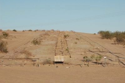
The Plank Road
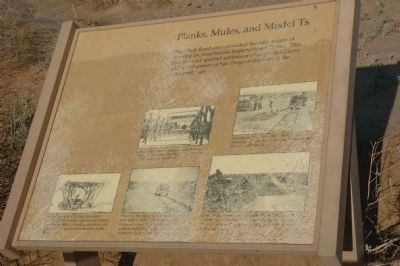
Planks, Mules, and Model Ts
Topics. This historical marker is listed in these topic lists: Animals • Roads & Vehicles • Settlements & Settlers.
Location. 32° 42.619′ N, 114° 55.367′ W. Marker is in Winterhaven, California, in Imperial County. Marker can be reached from Grays Well Road. Access Grays Well Road from Interstate 8 using Exit 158. Touch for map. Marker is in this post office area: Winterhaven CA 92283, United States of America. Touch for directions.
Other nearby markers. At least 7 other markers are within 13 miles of this marker, measured as the crow flies. A different marker also named Plank Road (within shouting distance of this marker); a different marker also named Plank Road (within shouting distance of this marker); Obregon (approx. 9 miles away); The Island of California (approx. 9.6 miles away); Site of Camp Pilot Knob (approx. 10.2 miles away); Mormon Battalion Crossing / Colorado River Crossing (approx. 11.7 miles away in Arizona); Tumco (approx. 12.4 miles away).
Photographed By Michael Kindig
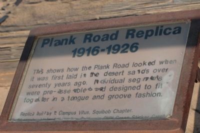
3. Plank Road Replica (1916-1926)
This nearby sign tells the story of the replica.
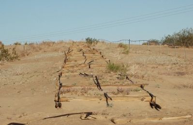
This shows how the Plank Road looked when it was first laid in the desert sands over seventy years ago. Individual segments were pre-assembled and designed to fit together in a tongue and groove fashion.
Replica built by E Clampus Vitus, Squibob Chapter.
Materials provided ... California OHV Green Sticker Grant.
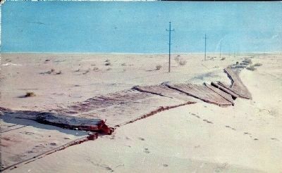
Photographed By Larry Holland, El Centro, California, circa 1955
5. The Old Plank Road
[This postcard image shows how the road appeared in the 1950's. Description on postcard reads:]
The Old Plank Road
..which parallels modern U.S. Highway 80 was constructed in 1913 to provide a stable route over constantly shifting sand dunes between Imperial Valley, Calif. and Yuma, Ariz. The road was constructed of planks held together with metal bands. It is the width of one automobile with occasional turn-outs for passing.
Credits. This page was last revised on August 17, 2020. It was originally submitted on December 17, 2011, by Michael Kindig of Elk Grove, California. This page has been viewed 801 times since then and 31 times this year. Photos: 1, 2, 3, 4. submitted on December 17, 2011, by Michael Kindig of Elk Grove, California. 5. submitted on December 17, 2011. • Syd Whittle was the editor who published this page.
