Grove Park in Atlanta in Fulton County, Georgia — The American South (South Atlantic)
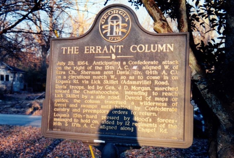
The Errant Column
Davisí troops, led by Gen. J, D. Morgan, marched toward the Chattahoochee, intending to reach Lick Skillet by a side road. Devoid of maps or guides, the column traversed a wilderness of forest & swamps until halted by Confederate cavalry & preemptory orders to return.
Loganís 15th -- hard pressed by Hoodís forces -- managed to hold on, aided by 12 regiments of the 16th & 17th A. C., aligned along Chapel Rd.
Erected 1988 by Georgia Department of Natural Resources. (Marker Number 060-138.)
Topics and series. This historical marker is listed in this topic list: War, US Civil. In addition, it is included in the Georgia Historical Society series list. A significant historical date for this entry is July 28, 1944.
Location. Marker has been reported missing. It was located near 33° 46.283′ N, 84° 26.167′ W. Marker was in Atlanta, Georgia, in Fulton County. It was in Grove Park. Marker was at the intersection of Donald Lee Hollowell Parkway (U.S. 278) and Elinor Place, on the right when traveling west on Donald Lee Hollowell Parkway. Touch for map. Marker was in this post office area: Atlanta GA 30318, United States of America. Touch for directions.
Other nearby markers. At least 8 other markers are within 2 miles of this location, measured as the crow flies. Davis' Hill (about 700 feet away, measured in a direct line); Fire Station No. 16 (approx. one mile away); Theodore ďTigerĒ Flowers (approx. one mile away); The Battle of Ezra Church / The Preliminary Operations (approx. 1.2 miles away); The Union Dispositions (approx. 1.2 miles away); The Confederate Attack (approx. 1.2 miles away); Battle of Ezra Church (approx. 1.2 miles away); Battle of Ezra Ch. (approx. 1.3 miles away). Touch for a list and map of all markers in Atlanta.
More about this marker. Text for the missing marker was taken from “Georgia Historical Markers” (Bay Tree Grove, Second Edition 1978) compiled by Carroll P. Scruggs from the records of the Georgia Historical Commission.
Credits. This page was last revised on February 8, 2023. It was originally submitted on December 17, 2011, by David Seibert of Sandy Springs, Georgia. This page has been viewed 520 times since then and 8 times this year. Photos: 1. submitted on October 6, 2020, by Tim Fillmon of Webster, Florida. 2, 3. submitted on December 17, 2011, by David Seibert of Sandy Springs, Georgia. • Craig Swain was the editor who published this page.


