Near Ocotillo in Imperial County, California — The American West (Pacific Coastal)
De Anza Overlook
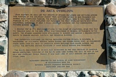
A second trip in 1775 brought settlers to the coast of California. Spain felt that its tenuous hold on the New World was threatened by Russian settle,nets to the North. The Spanish missions were struggling to survive and needed a reliable supply route to ensure military, political and religious success.
This expedition contained 240 people, including Captain De Anza, 38 soldiers, 15 muleteers, 136 colonists, several Indian guides, and Father Pedro Font, as chronicler. There were over 800 head of livestock, which included pack mules, horses, and cattle. The settlers became founders of what would become San Francisco.
The route discovered by De Anza was abandoned in the 1780s because of Quechan Indian hostilities. Portions of the route were used during the 1800s as part of the Gila and Overland Trails. Finally, it was also used by gold seekers and several stage lines.
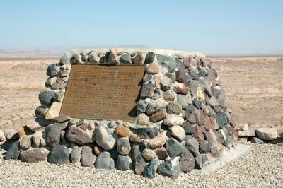
Erected 1990 by Bureau of Land Management in cooperation with the Imperial County Pioneers Historical Society.
Topics and series. This historical marker is listed in these topic lists: Exploration • Hispanic Americans. In addition, it is included in the Juan Bautista de Anza National Historic Trail series list. A significant historical year for this entry is 1774.
Location. 32° 41.726′ N, 115° 54.116′ W. Marker is near Ocotillo, California, in Imperial County. Marker is on Anza Trail Road. Marker is accessible by high-clearance vehicles only. Anza Trail Road can be reached by the Yuba Cutoff (State Route 98) 11 miles east of the Town of Ocotillo. Touch for map. Marker is in this post office area: Ocotillo CA 92259, United States of America. Touch for directions.
Other nearby markers. At least 5 other markers are within 12 miles of this marker, measured as the crow flies. Yuha Well (approx. 2 miles away); Geoglyphs (approx. 6.2 miles away); Imperial Valley Desert Museum (approx. 6.2 miles away); Mountain Springs Station Site (approx. 11.8 miles away); Desert Tower (approx. 11.8 miles away).
Also see . . . A KTEH TV Production of the DeAnza Trail on YouTube. In this video one learns the history and purpose of the DeAnza Expedition, the heritage of descendants of expedition members, and current sites along the trail. (Submitted on December 15, 2011.)
Credits. This page was last revised on March 18, 2022. It was originally submitted on December 10, 2011, by Michael Kindig of Elk Grove, California. This page has been viewed 1,226 times since then and 90 times this year. Last updated on December 18, 2011, by Michael Kindig of Elk Grove, California. Photos: 1, 2, 3. submitted on December 10, 2011, by Michael Kindig of Elk Grove, California. 4. submitted on January 14, 2014, by Duane Hall of Abilene, Texas. • Syd Whittle was the editor who published this page.


