Near Taos in Taos County, New Mexico — The American Mountains (Southwest)
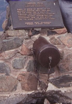
Wheeler Peak
13,161 Feet Above Sea Level
— Highest Point in New Mexico —
Erected by Wheeler Peak Wilderness - Carson National Forest.
Topics. This historical marker is listed in these topic lists: Anthropology & Archaeology • Exploration • Science & Medicine.
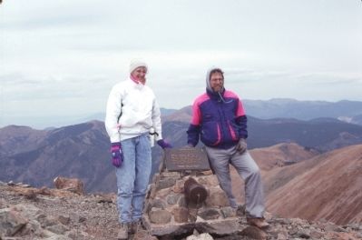
Location. 36° 33.405′ N, 105° 25.017′ W. Marker is near Taos, New Mexico, in Taos County. Marker can be reached from Twining-Blue Lake Back Pack Trail south of County Road 79. The marker is at the top of the 13,161 foot mountain, far from any road. It is accessible only by foot trail. The trail is rugged, cold, dangerous, windy and remote. Don't go up there unless fully prepared. Touch for map. Marker is in this post office area: Taos Ski Valley NM 87525, United States of America. Touch for directions.
Other nearby markers. At least 8 other markers are within 12 miles of this marker, measured as the crow flies. Elizabethtown (approx. 8.4 miles away); a different marker also named Wheeler Peak (approx. 8.4 miles away); Eagle Nest Lake State Park (approx. 10.1 miles away); Vietnam Veterans National Memorial (approx. 10.8 miles away); Palo Flechado Pass (approx. 10.8 miles away); Taos Pueblo (approx. 10.9 miles away); Taos Pueblo Veterans Memorial (approx. 10.9 miles away); Taos (approx. 12.1 miles away). Touch for a list and map of all markers in Taos.
Credits. This page was last revised on June 16, 2016. It was originally submitted on December 19, 2011, by Jamie Cox of Melbourne, Florida. This page has been viewed 1,127 times since then and 30 times this year. Photos: 1. submitted on December 30, 2011, by Jamie Cox of Melbourne, Florida. 2. submitted on December 19, 2011, by Jamie Cox of Melbourne, Florida. • Syd Whittle was the editor who published this page.

