Melbourne in Brevard County, Florida — The American South (South Atlantic)
Tin Can Tourist Campground
Photographed by Jamie Cox, November 27, 2011
1. Tin Can Tourist Campground Marker
Inscription.
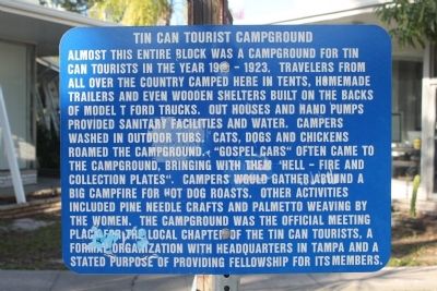
Tin Can Tourist Campground. . Almost this entire block was a campground for tin can tourists in the year 1918(?) - 1923. Travelers from all over the country camped here in tents, homemade trailers and even wooden shelters built on the back of Model T Ford trucks. Out houses and hand pumps provided sanitary facilities and water. Campers washed in outdoor tubs. Cats, dogs and chickens roamed the campground. "Gospel cars" often came to the campground, bringing with them "hell-fire and collection plates". Campers would gather around a big campfire for hot dog roasts. Other activities included pine needle crafts and palmetto weaving by the women. The campground was the official meeting place for the local chapter of the Tin Can Tourists, a formal organization with headquarters in Tampa and a stated purpose of providing fellowship for its members.
Almost this entire block was a campground for tin can tourists in the year 1918(?) - 1923. Travelers from all over the country camped here in tents, homemade trailers and even wooden shelters built on the back of Model T Ford trucks. Out houses and hand pumps provided sanitary facilities and water. Campers washed in outdoor tubs. Cats, dogs and chickens roamed the campground. "Gospel cars" often came to the campground, bringing with them "hell-fire and collection plates". Campers would gather around a big campfire for hot dog roasts. Other activities included pine needle crafts and palmetto weaving by the women. The campground was the official meeting place for the local chapter of the Tin Can Tourists, a formal organization with headquarters in Tampa and a stated purpose of providing fellowship for its members.
Topics. This historical marker is listed in this topic list: Roads & Vehicles. A significant historical year for this entry is 1923.
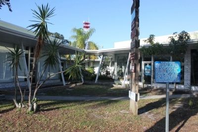
Location. 28° 4.715′ N, 80° 36.499′ W. Marker is in Melbourne, Florida, in Brevard County. It is on New Haven Avenue, on the left when traveling east. Touch for map. Marker is at or
Click or scan to see this page online
near this postal address: 720 New Haven Avenue, Melbourne FL 32901, United States of America. Touch for directions.
Regionally, this marker is in Florida’s Space Coast. It is also in the American South. Globally, it is in the North Atlantic Region, North America, a Gulf of Mexico state, the Western Hemisphere, the Western World, and the Anglosphere. Historically, it finds itself in what was once New Spain, the territory of the Mississippian Culture, one of the Confederate States of America, and the Antebellum South.
(was about 700 feet away, measured in a direct line but has been confirmed missing); Orange Spot Inn (was approx. 0.2 miles away but has been confirmed missing); Melbourne Hotel (was approx. 0.3 miles away but has been confirmed missing).
Additional keywords. Great Depression tourisim
Credits. This page was last revised on June 16, 2016. It was originally submitted on December 19, 2011, by Jamie Cox of Melbourne, Florida. This page has been viewed 1,436 times since then and 25 times this year. Photos:1, 2. submitted on December 19, 2011, by Jamie Cox of Melbourne, Florida. • Craig Swain was the editor who published this page.