Near Kanwaka in Douglas County, Kansas — The American Midwest (Upper Plains)
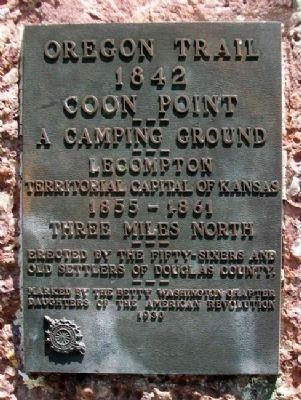
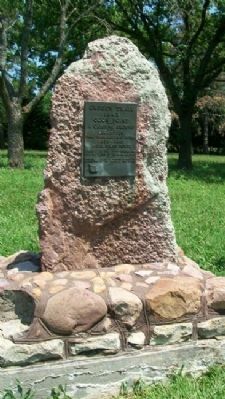
Coon Point
Oregon Trail
— 1842 —
Lecompton
Territorial Capital of Kansas
1855-1861
Three miles north
Erected 1930 by The Fifty-Sixers and Old Settlers of Douglas County, and the Betty Washington Chapter, D.A.R.
Topics and series. This historical marker is listed in these topic lists: Environment • Exploration • Roads & Vehicles • Settlements & Settlers. In addition, it is included in the Daughters of the American Revolution, and the Oregon Trail series lists.
Location. 38° 59.605′ N, 95° 23.446′ W. Marker is near Kanwaka, Kansas, in Douglas County. Marker is at the intersection of U.S. 40 and E 600 Road (County Route 1029), on the right when traveling west on U.S. 40. Marker is at the roadside rest area. Touch for map. Marker is in this post office area: Lawrence KS 66049, United States of America. Touch for directions.
Other nearby markers. At least 8 other markers are within 7 miles of this marker, measured as the crow flies. Lecompton (here, next to this marker); Lane University (approx. 3˝ miles away); Lecompton Constitution Hall (approx. 3.6 miles away); Sheriff Samuel J. Jones (approx. 3.6 miles away); Democratic Headquarters (approx. 3.8 miles away); First United Brethren in Christ Church in Kansas (approx. 5.2 miles away); Kansa Indians (approx. 5.8 miles away); Purple Heart Trail in Kansas (approx. 6.7 miles away).
Also see . . . Oregon National Historic Trail. (Submitted on December 19, 2011, by William Fischer, Jr. of Scranton, Pennsylvania.)
Credits. This page was last revised on June 16, 2016. It was originally submitted on December 19, 2011, by William Fischer, Jr. of Scranton, Pennsylvania. This page has been viewed 897 times since then and 73 times this year. Photos: 1, 2, 3. submitted on December 19, 2011, by William Fischer, Jr. of Scranton, Pennsylvania.


