Nichols in Marion County, South Carolina — The American South (South Atlantic)
Drowning Creek
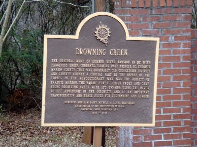
Photographed by J. J. Prats, January 26, 2008
1. Drowning Creek Marker
Erected 1987 by Drowning Creek Chapter, Daughters of the American Revolution. Honoring William Gairy Nichols, a local Historian, and the Bicentennial of the Constitution of U.S.A.
Topics and series. This historical marker is listed in these topic lists: War, US Revolutionary • Waterways & Vessels. In addition, it is included in the Daughters of the American Revolution (DAR) series list.
Location. 34° 13.682′ N, 79° 8.421′ W. Marker is in Nichols, South Carolina, in Marion County. It is on South Nichols Street (State Highway 9) east of Waccamaw
this page online

Regionally, this marker is in the Pee Dee. It is also in the American South and specifically in the Deep South. Globally, it is in North America, the Western Hemisphere, the Western World, and the Anglosphere. Historically, it finds itself in what was once the territory of the Mississippian Culture, one of the original Thirteen Colonies, one of the Confederate States of America, and the Antebellum South.
Other nearby markers. At least 8 other markers are within 12 miles of this marker, measured as the crow flies: Camp Victor Blue (about 400 feet away, measured in a direct line); Mt. Olive Baptist Church (approx. 6.4 miles away); Tobacco Culture (approx. 6.7 miles away); Mullins Depot / Mullins (approx. 6.7 miles away); Palmetto High School (approx. 7.4 miles away); The Meeting House (approx. 8.3 miles away); Ford’s Mill & Page’s Mill / Lake View (approx. 8½ miles away); Green Sea Baptist Church (approx. 11.7
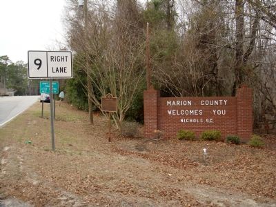
Photographed by J. J. Prats, January 26, 2008
2. Drowning Creek Marker
Another marker is no longer nearby. Christ Prayer Chapel (was approx. 6.7 miles away but has been confirmed missing).
Additional keywords. DAR
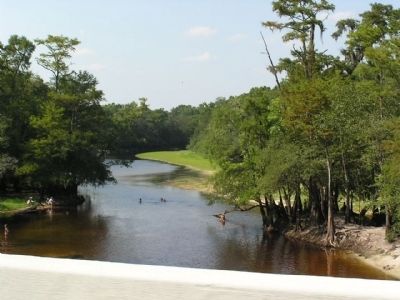
Photographed by Anna Inbody, August 7, 2011
3. Lumber River
Originally known as Drowning Creek, this picture of the Lumber River was taken from the bridge just east of the marker.
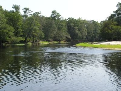
Photographed by Anna Inbody, August 7, 2011
4. Lumber River
This view shows the dangerous currents and terrain that had to be traversed by Francis Marion.
Credits. This page was last revised on September 18, 2020. It was originally submitted on January 31, 2008, by J. J. Prats of Powell, Ohio. This page has been viewed 5,962 times since then and 264 times this year. Photos: 1, 2. submitted on January 31, 2008, by J. J. Prats of Powell, Ohio. 3, 4. submitted on August 10, 2011, by Anna Inbody of Columbia, South Carolina.
