Woodmont in Arlington in Arlington County, Virginia — The American South (Mid-Atlantic)
Fort C.F. Smith
Mr. Lincoln’s Forts
— Defenses of Washington, 1861-1865 —
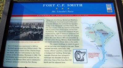
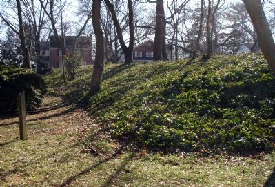
Along with forts Strong, Morton and Woodbury, Fort C.F. Smith functioned as part of the outer perimeter defenses that protected the Aqueduct bridge of the Chesapeake and Ohio Canal. The fort was a lunette with two bastions on the north side to protect from attack up the ravines from the Potomac. The original fort contained 22 gun emplacements, eight of which are preserved and visible today. The access road to the fort crossed Spout Run near Mason’s Mill and proceeded up the hill to Fort Strong. Military Road linked Fort C.F. Smith with Fort Ethan Allen to the north.
The support buildings in which the garrison ate and slept were located to the east. These included barracks, mess halls, cook houses, officers’ quarters, a barn and a headquarters’ building. Period photographs illustrate how Arlington’s landscape was denuded of trees to allow clear lines of fire from Fort C.F. Smith and the adjacent forts.
Erected by Virginia Civil War Trails.
Topics and series. This historical marker is listed in these topic lists: Forts and Castles • War, US Civil • Waterways & Vessels. In addition, it is included in the Chesapeake and Ohio (C&O) Canal, the Defenses of Washington, and the Virginia Civil War Trails series lists. A significant historical year for this entry is 1863.
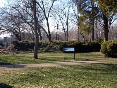
Location. This marker has been replaced by another marker nearby. It was located near 38° 54.055′ N, 77° 5.447′ W. Marker was in Arlington, Virginia, in Arlington County. It was in Woodmont. Marker could be reached from 24th Street North. Marker is in Fort C.F. Smith Park. Touch for map. Marker was at or near this postal address: 2411 24th Street North, Arlington VA 22207, United States of America. Touch for directions.
Other nearby markers. At least 8 other markers are within walking distance of this location. A different marker also named Fort C.F. Smith (a few steps from this marker); a different marker also named Fort C.F. Smith (a few steps from this marker); a different marker also named Fort C.F. Smith (within shouting distance of this marker); a different marker also named Fort C.F. Smith (about 700 feet away, measured in a direct line); Maywood (approx. 0.3 miles away); Fort Strong (approx. 0.4 miles
away); The Dawson-Bailey House (approx. 0.4 miles away); The Dawson-Bailey Spring Site (approx. half a mile away). Touch for a list and map of all markers in Arlington.
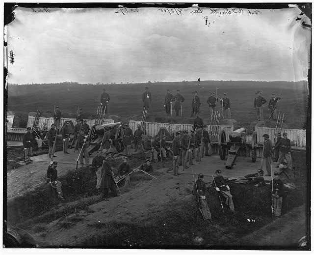
More about this marker. On the upper of left of the marker is a photo captioned "Co. F, 2nd New York Heavy Artillery at Fort C.F. Smith, August, 1864." On the right of the marker is featured a sketch and a map captioned "Defenses of Washington showing location and design (inset) of Fort C.F. Smith."
Related marker. Click here for another marker that is related to this marker. This marker has replaced the linked marker which had slightly different content.
Also see . . . Fort C.F. Smith Park. Arlington County Department of Parks, Recreation and Community Resources website. (Submitted on February 2, 2008.)

Library of Congress
3. Interior view of Fort C. F. Smith
This photo is reproduced on the marker on the upper left. It shows gun crews of Company L, 2d New York Artillery in the fort. The guns are two 24-pdr siege guns from the fort's main armament. Notice the ground in front of the fort in the background. Where the ground at the time was wide open space, today Interstate 66 passes through residential Arlington.
(Civil War photographs, 1861-1865 / compiled by Hirst D. Milhollen and Donald H. Mugridge, Washington, D.C. : Library of Congress, 1977. No. 0762)
(Civil War photographs, 1861-1865 / compiled by Hirst D. Milhollen and Donald H. Mugridge, Washington, D.C. : Library of Congress, 1977. No. 0762)
Credits. This page was last revised on February 1, 2023. It was originally submitted on February 2, 2008. This page has been viewed 1,472 times since then and 15 times this year. Photos: 1, 2. submitted on February 2, 2008. 3. submitted on February 3, 2008, by Craig Swain of Leesburg, Virginia. 4. submitted on February 2, 2008. • Craig Swain was the editor who published this page.


