Near Rimforest in San Bernardino County, California — The American West (Pacific Coastal)
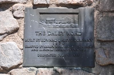
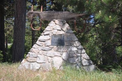
The Daley Road
1870
Erected 1935 by Arrowhead Parlor 110, N.S.G.W. and Lugonia Parlor 271, N.D.G.W. (Marker Number 579.)
Topics and series. This historical marker is listed in this topic list: Roads & Vehicles. In addition, it is included in the California Historical Landmarks, and the Native Sons/Daughters of the Golden West series lists. A significant historical year for this entry is 1870.
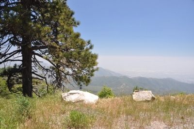
Location. 34° 13.831′ N, 117° 12.956′ W. Marker is near Rimforest, California, in San Bernardino County. Marker is on Rim of the World Highway (California Route 18 at milepost 23.3) south of Daley Canyon Road, on the right when traveling east. Touch for map. Marker is at or near this postal address: 26862 Rim of the World Highway, Rimforest CA 92378, United States of America. Touch for directions.
Other nearby markers. At least 8 other markers are within 7 miles of this marker, measured as the crow flies. Donald S. Wieman (approx. 1.4 miles away); Lake Arrowhead Veterans Monument (approx. 1.4 miles away); Memorial to Pauliena LaFuze (approx. 1.7 miles away); Club Arrowhead in the Pines (approx. 1.7 miles away); Mountain History Museum (approx. 2.2 miles away); Mormon Lumber Road (approx. 4˝ miles away); The Arrowhead Landmark (approx. 5.6 miles away); Patton State Hospital (approx. 6˝ miles away).
Regarding The Daley Road. The Daley Road, built by Edward Daley and Co. in 1870, was one of the first roads into the San Bernardino Mountains that could accommodate wagons. It was a toll road until 1890, when it became a county road. Now a Forest Service fire road, it is not open to the public. SOURCE: California Historical Landmarks, California State Parks
Also see . . . Edward Barber Daley, Sr (1825 - 1896) - Find A Grave Memorial. (Submitted on January 2, 2012, by Michael Kindig of Elk Grove, California.)
Credits. This page was last revised on June 16, 2016. It was originally submitted on December 28, 2011, by Michael Kindig of Elk Grove, California. This page has been viewed 847 times since then and 20 times this year. Photos: 1. submitted on December 28, 2011, by Michael Kindig of Elk Grove, California. 2, 3. submitted on January 2, 2012, by Michael Kindig of Elk Grove, California. • Syd Whittle was the editor who published this page.


