Colton in San Bernardino County, California — The American West (Pacific Coastal)
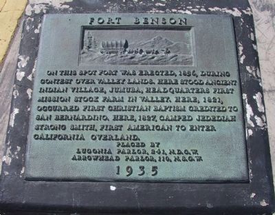
Fort Benson
Erected 1935 by Lugonia Parlor No, 241, N.D.G.W and Arrowhead Parlor No. 110, N.S.G.W. (Marker Number 617.)
Topics and series. This historical marker is listed in these topic lists: Forts and Castles • Native Americans • Notable Places • Settlements & Settlers. In addition, it is included in the California Historical Landmarks, and the Native Sons/Daughters of the Golden West series lists. A significant historical month for this entry is January 1827.
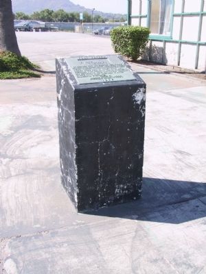
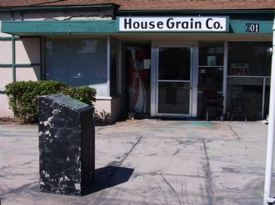
Location. 34° 3.675′ N, 117° 17.259′ W. Marker is in Colton, California, in San Bernardino County. Marker is at the intersection of South Hunts Lane and East Oliver Holmes Road, on the right when traveling south on South Hunts Lane. Marker is located at the truck scale. Touch for map. Marker is at or near this postal address: 601 South Hunts Lane, San Bernardino CA 92408, United States of America. Touch for directions.
Other nearby markers. At least 8 other markers are within 4 miles of this marker, measured as the crow flies. Guachama Rancheria (approx. 2.9 miles away); 60th Anniversary of the CCC (approx. 3 miles away); Site of Mormon Stockade (approx. 3.1 miles away); To Jedediah Smith (approx. 3.1 miles away); California Theater (approx. 3.2 miles away); San Bernardino Santa Fe Depot (approx. 3.2 miles away); Mitla Café (approx. 3.7 miles away); War Memorial (approx. 3.8 miles away).
Regarding Fort Benson. It was on Jumuba that For Benson was erected in the late 1850's by Jerome Benson, who raised earthworks and loaded a cannon with rocks to protect his land against seizure by the Mormons who dominated the region. SOURCE: California A Guide to the Golden State by Federal Writers' Project
In 1957 this was designated California Historical Landmark No. 617.
Also see . . . Jerome Messenger Benson (1810 - 1877) - Find A Grave Memorial. (Submitted on January 2, 2012, by Michael Kindig of Elk Grove, California.)
Credits. This page was last revised on February 5, 2024. It was originally submitted on December 28, 2011, by Michael Kindig of Elk Grove, California. This page has been viewed 1,590 times since then and 41 times this year. Photos: 1, 2, 3. submitted on December 28, 2011, by Michael Kindig of Elk Grove, California. • Syd Whittle was the editor who published this page.


