Near Valley Grove in Ohio County, West Virginia — The American South (Appalachia)
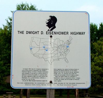
The Dwight D. Eisenhower Highway
In August 1973, the U.S. Congress designated a cross-country stretch of Interstate as the “Dwight D. Eisenhower Highway,” in tribute to President Eisenhower’s early recognition of the need for a national network of highways to enhance the mobility of a growing nation. His dream originated in 1919 on an Army convoy from Washington, D.C., to San Francisco, California, a journey that took 62 days.
On June 29, 1956, President Eisenhower signed the historic legislation that created the National System of Interstate and Defense Highways and the Federal Highway Trust Fund, the pay-as-you-go mechanism through which U.S. motorists have funded the construction and upkeep of the U.S. highway system.
Today, that system stands as a monument to Eisenhower’s vision as a young Army officer—a legacy of safety and mobility that has brought all Americans closer together.
Erected by the American Traffic Safety Services Association and the Road Information Program.
Topics and series. This historical marker is listed in this topic list: Roads & Vehicles. In addition, it is included in the Former U.S. Presidents: #34 Dwight D. Eisenhower series list. A significant historical month for this entry is June 1755.
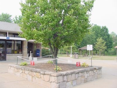
Location. Marker has been reported missing. It was located near 40° 5.505′ N, 80° 32.155′ W. Marker was near Valley Grove, West Virginia, in Ohio County. Marker could be reached from West Virginia Welcome Center (Interstate 70) west of the Pennsylvania state line, on the right when traveling west. Touch for map. Marker was in this post office area: Valley Grove WV 26060, United States of America. Touch for directions.
Other nearby markers. At least 5 other markers are within 2 miles of this location, measured as the crow flies. Ray’s Arithmetic (approx. 1.1 miles away); Ohio County / State of Pennsylvania (approx. 1.2 miles away); Revolutionary War Soldiers (approx. 1.6 miles away in Pennsylvania); Veterans Memorial (approx. 1.6 miles away in Pennsylvania); General Lafayette (approx. 1.6 miles away in Pennsylvania). Touch for a list and map of all markers in Valley Grove.
More about this marker. The “pay-as-you-go mechanism” discussed on the marker is the federal tax on gasoline.
Also see . . . Dwight D. Eisenhower Highway. (Submitted on September 2, 2006.)
Credits. This page was last revised on April 24, 2022. It was originally submitted on September 2, 2006, by J. J. Prats of Powell, Ohio. This page has been viewed 1,511 times since then and 16 times this year. Photos: 1, 2. submitted on September 2, 2006, by J. J. Prats of Powell, Ohio.

