Marker Logo HMdb.org THE HISTORICAL
MARKER DATABASE
“Bite-Size Bits of Local, National, and Global History”
Near Elm Grove in Ohio County, West Virginia — The American South (Appalachia)
 

The National Pike


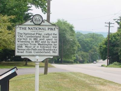
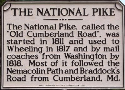
The National Pike Marker image. Click for full size.
Photographed By Allen C. Browne, August 31, 2005
1. The National Pike Marker
Inscription. The National Pike, called the “Old Cumberland Road” , was started in 1811 and used to Wheeling in 1817 and by mail coaches from Washington by 1818. Most of it followed the Nemacolin Path and Braddock’s Road from Cumberland, Md.
 
Erected 1965 by West Virginia Historic Commission.
 
Topics and series. This historical marker is listed in this topic list: Roads & Vehicles. In addition, it is included in the The Historic National Road, and the West Virginia Archives and History series lists. A significant historical year for this entry is 1811.
 
Location. 40° 3.343′ N, 80° 40.159′ W. Marker is near Elm Grove, West Virginia, in Ohio County. Marker is on National Road (U.S. 40) east of Wheeling Park Drive, on the right when traveling west. Touch for map. Marker is in this post office area: Wheeling WV 26003, United States of America. Touch for directions.
 
Other nearby markers. At least 5 other markers are within walking distance of this marker. The Madonna of the Trail (here, next to this marker); a different marker also named Madonna of the Trail (a few steps from this marker); Sara Lucy Bagby (a few steps from this marker); Joseph Thoburn (a few steps from this marker); State’s Birthplace (a few steps from this marker). Touch for a list and map of all markers in Elm Grove.
 
Also see . . .  The Old Pike : A History of the National Road: With Incidents, Accidents and Anecdotes Thereon
Paid Advertisement
Click on the ad for more information.
Please report objectionable advertising to the Editor.
Click or scan to see
this page online
. 1894 hardcover Book by Thomas B. Searight, ocassionally available on Amazon.com. (Submitted on September 2, 2006.) This website may earn income if you use this link to make a purchase on Amazon.com. 
 
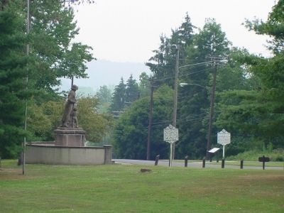
The National Pike and Marker image. Click for full size.
Photographed By J. J. Prats, August 27, 2006
2. The National Pike and Marker
This Marker is the Rightmost Marker of the Four image. Click for full size.
Photographed By J. J. Prats, August 27, 2006
3. This Marker is the Rightmost Marker of the Four
To the left one can see the Madonna of the Trail, one of twelve identical monuments commissioned by the Daugthers of the American Revolution in 1928-1929.
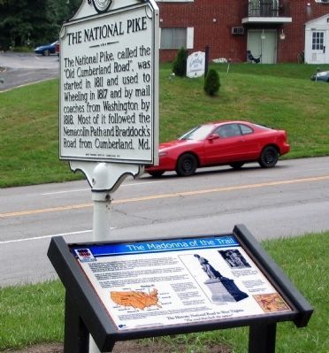
The National Pike and Madonna of the Trail Markers image. Click for full size.
Photographed By Allen C. Browne, August 31, 2005
4. The National Pike and Madonna of the Trail Markers
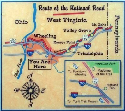
Route of the National Road in West Virginia image. Click for full size.
5. Route of the National Road in West Virginia
You-are-Here map.
From the Madonna of the Trail marker
 
 
Credits. This page was last revised on January 4, 2022. It was originally submitted on September 2, 2006, by J. J. Prats of Powell, Ohio. This page has been viewed 1,962 times since then and 29 times this year. Photos:   1. submitted on April 8, 2013, by Allen C. Browne of Silver Spring, Maryland.   2, 3. submitted on September 2, 2006, by J. J. Prats of Powell, Ohio.   4, 5. submitted on April 8, 2013, by Allen C. Browne of Silver Spring, Maryland.
Share this page.  
Share on Tumblr
m=512

CeraNet Cloud Computing sponsors the Historical Marker Database.
This website earns income from purchases you make after using our links to Amazon.com. We appreciate your support.
Paid Advertisement
Apr. 24, 2024