Sterling in Logan County, Colorado — The American Mountains (Southwest)
The Overland Trail
Photographed by Barry Swackhamer, December 8, 2011
1. The Overland Trail Marker
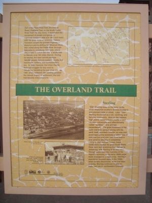
[Captions: map, upper right] Courtesy Nell Brown Propst, from her book Forgotten People: A History of the South Platte Trail [lower left] Above: Sterling, Colorado, 1936. Colorado Historical Society; Right: In a photograph taken near Sterling, a family poses in front of a sod house built about1860. Colorado Historical Society.
Inscription.
The Overland Trail. . Call it the Pikes Peak Trail, the Denver Road, Overland Trail, or the South Platte River Trail – by any name, it dominated the movement of people and goods in Colorado between 1858 and 1867 and ranks with the great trails of American history. Travelers caught the pioneer highway at departure points dotting the Missouri River, then rolled along the Platte River through Nebraska to Julesburg, Colorado, where they turned to follow the river’s south fork to Denver, only 180 miles distant. During it heyday, the road carried perhaps 166,000 people, fortune-seekers mostly, but merchants, settlers, and homesteaders, too. In 1866, however, the Union Pacific Railroad chugged its way west to Julesburg, heralding the end of an era. By 1881, when railheads like Sterling greeted the newest engine of settlement, the trail had become only a memory.
Sterling , “Old” Sterling dates to the early 1870s, when displaced southern families moved in and planted fields of wheat. Later, “new: Sterling flourished as a rail, ranching, and farming community. Here on the treeless high plains, settlers found shelter in sod houses – universally and affectionately called “soddies.” One pioneer remembered: “The great thickness of the walls and their perfect joining with the early itself provided a shelter so cozy and proof against the extremes of either heat or cold that [no one] who had once lived in one cared to abandon it completely.” Living in their earthen homes, these sodbusters created the great South Platte farm belt stretching from Denver to Julesburg, with Sterling at its very heart. Though cattle were the mainstay of the region’s economy, in the early 1900s sugar beets emerged as a major crop. Sterling’s population boomed again in the 1950s when oil was discovered. From trail days to today, Sterling continues to play an important role in northeastern Colorado.
Call it the Pikes Peak Trail, the Denver Road, Overland Trail, or the South Platte River Trail – by any name, it dominated the movement of people and goods in Colorado between 1858 and 1867 and ranks with the great trails of American history. Travelers caught the pioneer highway at departure points dotting the Missouri River, then rolled along the Platte River through Nebraska to Julesburg, Colorado, where they turned to follow the river’s south fork to Denver, only 180 miles distant. During it heyday, the road carried perhaps 166,000 people, fortune-seekers mostly, but merchants, settlers, and homesteaders, too. In 1866, however, the Union Pacific Railroad chugged its way west to Julesburg, heralding the end of an era. By 1881, when railheads like Sterling greeted the newest engine of settlement, the trail had become only a memory.
Sterling
“Old” Sterling dates to the early 1870s, when displaced southern families moved in and planted fields of wheat. Later, “new: Sterling flourished as a rail, ranching, and farming community. Here on the treeless high plains, settlers found shelter in sod houses – universally and affectionately called “soddies.” One pioneer remembered: “The great thickness of the walls and their perfect joining with the early itself provided a shelter so
Click or scan to see this page online
cozy and proof against the extremes of either heat or cold that [no one] who had once lived in one cared to abandon it completely.” Living in their earthen homes, these sodbusters created the great South Platte farm belt stretching from Denver to Julesburg, with Sterling at its very heart. Though cattle were the mainstay of the region’s economy, in the early 1900s sugar beets emerged as a major crop. Sterling’s population boomed again in the 1950s when oil was discovered. From trail days to today, Sterling continues to play an important role in northeastern Colorado.
Erected 1999 by Colorado Historical Society. (Marker Number 227.)
Topics and series. This historical marker is listed in these topic lists: Roads & Vehicles • Settlements & Settlers. In addition, it is included in the History Colorado series list. A significant historical year for this entry is 1858.
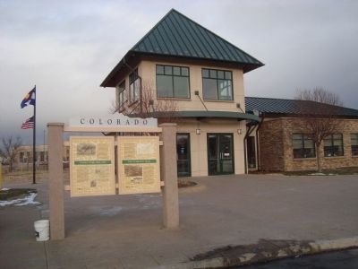
Location. 40° 37.211′ N, 103° 10.81′ W. Marker is in Sterling, Colorado, in Logan County. It is at the intersection of County Road 370 and U.S. 6 on County Road 370. This marker is located in front of the Visitor's Center. Touch for map. Marker is at or near this postal address: 13074 County Road 370, Sterling CO 80751, United States of America. Touch for directions.
Regionally, this marker is in the Eastern Plains. It is also in the American Mountain West, on the Great Plains, and specifically on the High Plains. Globally, it is in North America, the Western Hemisphere, the Western World, and the Anglosphere. Historically, it finds itself in what was once the Louisiana Purchase.
Other nearby markers. At least 8 other markers are within 2 miles of this marker, measured as the crow flies: Indian Wars 1864-1869 (here, next to this marker); Original Building
Photographed by Barry Swackhamer, December 8, 2011
Credits. This page was last revised on June 16, 2016. It was originally submitted on January 1, 2012, by Barry Swackhamer of Brentwood, California. This page has been viewed 1,342 times since then and 36 times this year. Photos:1, 2. submitted on January 1, 2012, by Barry Swackhamer of Brentwood, California. • Bill Pfingsten was the editor who published this page.