
Sterling in Logan County, Colorado — The American Mountains (Southwest)
Indian Wars 1864-1869
Photographed by Barry Swackhamer, December 8, 2011
1. Indian Wars 1864-1869 Marker
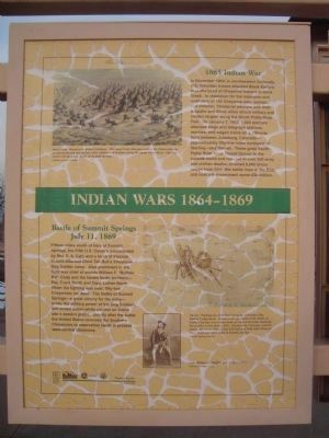
[Captons: top left] Sand Creek Massacre by Robert Lindneux. The Sand Creek Massacre united the Plains tribes in an unprecedented war against white soldiers and civilians along the South Platte River. The war ended with the tragic Battle of Summit Springs. Colorado Historical Society. [bottom right] Above: “Fighting the Wolf Men” form the Cheyenne Dog Soldier Ledgerbook. Found in the aftermath of the Battle of Summit Springs was a ledgerbook of colored drawings depicting the conflict on the plains, 1865. Rendered by Cheyenne warrior-artists, this image shows Chief Tall Bull and Wolf with Plenty of Hair. Both men were killed at Summit Springs. Colorado Historical Society; Left: William F. “Buffalo Bill” Cody, c. 1867. Colorado Historical Society.
Battle of Summit Springs
July 11, 1869
Fifteen miles south of here at Summit Springs, the Fifth U.S. Cavalry, commanded by Maj. E.A. Carr, and a force of Pawnee Scouts attacked Chief Tall Bull’s Cheyenne Dog Soldier camp. Also prominent in the fight was chief of scouts William F. “Buffalo Bill” Cody and the famed North brothers – Maj. Frank North and Capt. Luther North. When the fighting was over, fifty-two Cheyennes lay dead. The Battle of Summit Springs – a great victory for the army – broke the military power of the Dog Soldiers and ended Indian-white conflict on Colorado’s eastern plains. Shortly after the battle the United States removed the Southern Cheyennes to reservation lands in present west-central Oklahoma.
Erected 1999
this page online
Topics and series. This historical marker is listed in this topic list: Wars, US Indian. In addition, it is included in the History Colorado series list. A significant historical month for this entry is January 1835.
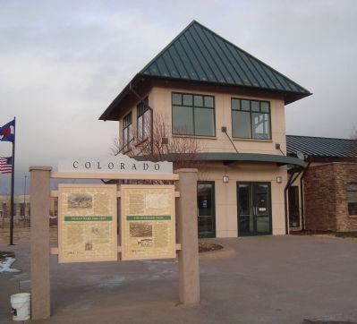
Location. 40° 37.212′ N, 103° 10.807′ W. Marker is in Sterling, Colorado, in Logan County. It is on County Road 370 near U.S. 6. This marker is located in front of the Visitor's Center. Touch for map. Marker is at or near this postal address: 13074 County Road 370, Sterling CO 80751, United States of America. Touch for directions.

Regionally, this marker is in the Eastern Plains. It is also in the American Mountain West, on the Great Plains, and specifically on the High Plains. Globally, it is in North America, the Western Hemisphere, the Western World, and the Anglosphere. Historically, it finds itself in what was once the Louisiana Purchase.
Other nearby markers. At least 8 other markers are within 2 miles of this marker, measured as the crow flies: The Overland Trail (here, next to this marker); Original Building (about 700 feet away, measured in a direct line); Valley Station (about 700 feet away); Old Sterling (about 700 feet away); William Shaw Hadfield (approx. 1.4 miles away); Sterling Union Pacific Railroad Depot (approx. 1.4 miles away); I & M Building (approx. 1½ miles away); Replica of the Statue of Liberty (approx. 1.6 miles away). Touch for a list and map of all markers in Sterling.
Also see . . .
1. Summit Springs Battlefield. (Submitted on January 1, 2012, by Barry Swackhamer of Brentwood, California.)
2. Battle of Summit Springs. (Submitted on January 1, 2012, by Barry Swackhamer of Brentwood, California.)
Photographed by Barry Swackhamer, December 8, 2011
2. Indian Wars 1864-1869 Marker
Credits. This page was last revised on June 16, 2016. It was originally submitted on January 1, 2012, by Barry Swackhamer of Brentwood, California. This page has been viewed 2,111 times since then and 56 times this year. Photos: 1, 2. submitted on January 1, 2012, by Barry Swackhamer of Brentwood, California. • Bill Pfingsten was the editor who published this page.
