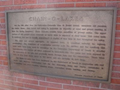
Chain – O – Lakes
The sand and gravel aggregate, as exposed here is excellent material for highway construction. The abundance of construction material near the surface and the relatively high water table have been used to advantage by the Nebraska Department of Roads in creating approximately 100 borrow pit lakes adjacent to Interstate 80. The water has been exposed by the excavation of the pits and gradually moves through them and the subsurface. These lakes vary in size from three acres to 50 acres and are normally 15 feet deep.
The Chain – O – Lakes has been developed by the Department of Roads in conjunction with rest areas and highway landscaping and by the Nebraska Game and Parks Commission in conjunction with road ranches, camping areas, recreation areas, hunting and fishing.
Erected by Nebraska Department of Roads
Topics. This historical marker is listed in these topic lists: Roads & Vehicles • Waterways & Vessels.
Location. 41° 6.411′ N, 101° 45.398′ W. Marker is in Ogallala, Nebraska, in Keith County. Marker can be reached from Interstate 80. This marker is located at the Ogallala Rest Stop on Interstate 80. The rest stop is on the south side of the highway while heading east. Touch for map. Marker is in this post office area: Ogallala NE 69153, United States of America. Touch for directions.
Other nearby markers. At least 8 other markers are within 3 miles of this marker, measured as the crow flies. Purple Heart (within shouting distance of this marker); Samuel David “Lep” Sanders (approx. 1˝ miles away); Oregon Trail (approx. 1.9 miles away); Sand Hill Station (approx. 1.9 miles away); The Lincoln Highway (approx. 2.3 miles away); Interstate 80 (approx. 2.3 miles away); The Union Pacific (approx. 2.3 miles away); The Mormon Trail (approx. 2.3 miles away). Touch for a list and map of all markers in Ogallala.
Credits. This page was last revised on August 13, 2020. It was originally submitted on January 2, 2012, by Barry Swackhamer of Brentwood, California. This page has been viewed 686 times since then and 15 times this year. Photos: 1, 2. submitted on January 2, 2012, by Barry Swackhamer of Brentwood, California. • Bill Pfingsten was the editor who published this page.

