Wadena in Wadena County, Minnesota — The American Midwest (Upper Plains)
The Red River Trail
Photographed By John Kempf, July 3, 2010
1. The Red River Trail Marker
Inscription.
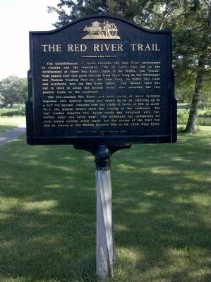
The Red River Trail. . The establishment of trade between the Red River settlements in Canada and the emerging City of Saint Paul led to the development of three Red River Trails on the 1840's. The "woods" trail passed over this point enroute from Crow Wing on the Mississippi and Wadena Trading Post on the Crow Wing, to Otter Tail Lake and northerly into the Red River Valley. The "woods" trail was cut in 1844 to avoid the hostile Sioux who menaced the two prairie trails to the southwest., The two-wheeled Red River cart built wholly of wood fastened together with rawhide thongs and drawn by an ox carrying up to a half ton burden, rumbled over the trails in trains of 100 or more. From the middle 1840's until the coming of the railroads, the cart hauled supplies and liquor north and returned with fur, buffalo robes and dried meat. The plowshare has obliterated its once deeply marked triple track, but the course of the trail can still be viewed at Old Wadena Historic Site on the Crow Wing River.
The establishment of trade between the Red River settlements in Canada and the emerging City of Saint Paul led to the development of three Red River Trails on the 1840's. The "woods" trail passed over this point enroute from Crow Wing on the Mississippi and Wadena Trading Post on the Crow Wing, to Otter Tail Lake and northerly into the Red River Valley. The "woods" trail was cut in 1844 to avoid the hostile Sioux who menaced the two prairie trails to the southwest.
The two-wheeled Red River cart built wholly of wood fastened together with rawhide thongs and drawn by an ox carrying up to a half ton burden, rumbled over the trails in trains of 100 or more. From the middle 1840's until the coming of the railroads, the cart hauled supplies and liquor north and returned with fur, buffalo robes and dried meat. The plowshare has obliterated its once deeply marked triple track, but the course of the trail can still be viewed at Old Wadena Historic Site on the Crow Wing River.
is in Wadena, Minnesota, in Wadena County. Marker can be reached from Harry Rich Drive. Marker is on the Sunnybrook Park disc golf course, between "hole" 1 and tee 2. Touch for map. Marker is in this post office area: Wadena MN 56482, United States of America. Touch for directions.
Credits. This page was last revised on June 16, 2016. It was originally submitted on July 3, 2010, by John Kempf of Wadena, Minnesota. This page has been viewed 1,395 times since then and 24 times this year. Last updated on January 3, 2012, by Paul Fehrenbach of Germantown, Wisconsin. Photo1. submitted on July 3, 2010, by John Kempf of Wadena, Minnesota. • Bill Pfingsten was the editor who published this page.