Leesburg in Loudoun County, Virginia — The American South (Mid-Atlantic)
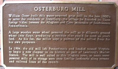
Osterburg Mill
A large wooden water wheel powered the mill as it diligently ground wheat into flour, producing a residue that could be used as stock feed. As his fee, the miller kept a portion of the milled flour for his own purposes.
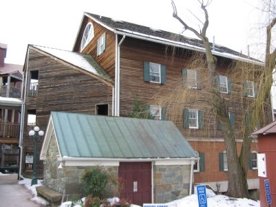
In 1984, the old mill left Pennsylvania and headed toward Virginia to begin a new chapter in its history as part of Leesburg's Market Station. The mill is well suited to this Virginia town, as many water powered mils of its vintage were once familiar landmarks along streams and railroad lines of the county.
Topics. This historical marker is listed in this topic list: Industry & Commerce. A significant historical year for this entry is 1984.
Location. 39° 6.767′ N, 77° 33.788′ W. Marker is in Leesburg, Virginia, in Loudoun County. Marker can be reached from Harrison Street, on the right when traveling south. Touch for map. Marker is in this post office area: Leesburg VA 20175, United States of America. Touch for directions.
Other nearby markers. At least 8 other markers are within walking distance of this marker. Dairy Barn (within shouting distance of this marker); McKimmey's Mill (within shouting distance of this marker); The Depot (within shouting distance of this marker); Norman-Harding Barn (within shouting distance of this marker); Log House (within shouting distance of this marker); Stationmaster's House (within shouting distance of this marker); The Tolbert Building (about 400 feet away, measured in a direct line); 7 Loudoun Street Southeast (about 600 feet away). Touch for a list and map of all markers in Leesburg.
Also see . . . Early 19th-Century Milling and Wheat Farming. A study of Loudoun's milling and farming in the 19th century. (Submitted on February 3, 2008, by Craig Swain of Leesburg, Virginia.)
Credits. This page was last revised on June 16, 2016. It was originally submitted on February 3, 2008, by Craig Swain of Leesburg, Virginia. This page has been viewed 1,685 times since then and 22 times this year. Photos: 1, 2, 3. submitted on February 3, 2008, by Craig Swain of Leesburg, Virginia.


