Medon in Madison County, Tennessee — The American South (East South Central)
Armstrong's Raid
Aug. 25 - Sept. 3, 1862
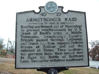
Photographed by Ken Smith, November 14, 2008
1. Armstrong's Raid Marker
Erected by Tennessee Historical Commission. (Marker Number 4D 27.)
Topics and series. This historical marker is listed in this topic list: War, US Civil. In addition, it is included in the Former U.S. Presidents: #18 Ulysses S. Grant, and the Tennessee Historical Commission series lists.
Location. 35° 27.423′ N, 88° 52.124′ W. Marker is in Medon, Tennessee, in Madison County. It is at the intersection of Main Street (State Highway 18) and Bowman Road, on the left when traveling north on Main Street. Touch for map. Marker is in this post office area: Medon TN 38356, United States of America. Touch for directions.

Regionally, this marker is in West Tennessee. It is also in the American South, specifically
this page online
Other nearby markers. At least 8 other markers are within 7 miles of this marker, measured as the crow flies: Britton Lane (approx. 5½ miles away); 7th Tennessee Cavalry Memorial (approx. 5½ miles away); Battle of Britton Lane (approx. 5½ miles away); Battle of Britton's Lane (approx. 5½ miles away); On June 6, 1862 (approx. 5½ miles away); Britton Lane Union Monument (approx. 5½ miles away); John Lee "Sonny Boy" Williamson (approx. 6.7 miles away); The "Fields-Brewer" Cabin (approx. 6.9 miles away).
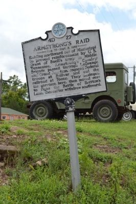
Photographed by Phillip Knecht, June 27, 2015
2. Armstrong's Raid Marker
Credits. This page was last revised on June 16, 2016. It was originally submitted on January 6, 2012, by Ken Smith of Milan, Tennessee. This page has been viewed 1,167 times since then and 52 times this year. Photos: 1. submitted on January 6, 2012, by Ken Smith of Milan, Tennessee. 2. submitted on June 28, 2015, by Phillip Knecht of Holly Springs, Mississippi. • Craig Swain was the editor who published this page.
