Near Frankfort Springs in Beaver County, Pennsylvania — The American Northeast (Mid-Atlantic)
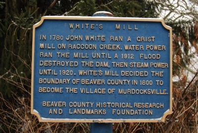
White's Mill
In 1780 John White ran a grist mill on Raccoon Creek. Water power ran the mill until a 1912 flood destroyed the dam then steam power until 1920. White's Mill decided the boundary of Beaver County in 1800 to become the village of Murdocksville.
Erected by Beaver County Historical Research and Landmarks Foundation.
Topics and series. This historical marker is listed in these topic lists: Industry & Commerce • Political Subdivisions • Waterways & Vessels. In addition, it is included in the Pennsylvania - Beaver County Historical Research and Landmarks Foundation series list. A significant historical year for this entry is 1780.
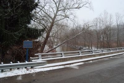
Location. 40° 28.666′ N, 80° 21.732′ W. Marker is near Frankfort Springs, Pennsylvania, in Beaver County. Marker is at the intersection of Clinton-Franklin Road and Murdocksville Road, on the right when traveling west on Clinton-Franklin Road. Touch for map. Marker is in this post office area: Clinton PA 15026, United States of America. Touch for directions.
Other nearby markers. At least 8 other markers are within 7 miles of this marker, measured as the crow flies. Frankfort Mineral Springs (approx. 3.7 miles away); Levi Dungan Land Patent (approx. 4˝ miles away); Elisha McCurdy (approx. 5 miles away); Crossroads Presbyterian Church (approx. 5 miles away); Revolutionary War Soldiers (approx. 5 miles away); David Littell House (approx. 5.9 miles away); a different marker also named Revolutionary War Soldiers (approx. 6˝ miles away); Burgettstown War Memorial (approx. 6.6 miles away).
Also see . . . Beaver County Historical Research and Landmarks Foundation. Website homepage (Submitted on January 13, 2012, by Mike Wintermantel of Pittsburgh, Pennsylvania.)
Credits. This page was last revised on July 27, 2022. It was originally submitted on January 13, 2012, by Mike Wintermantel of Pittsburgh, Pennsylvania. This page has been viewed 853 times since then and 14 times this year. Photos: 1, 2. submitted on January 13, 2012, by Mike Wintermantel of Pittsburgh, Pennsylvania.

