Central Business District in New Orleans in Orleans Parish, Louisiana — The American South (West South Central)
Canal Street Historic District
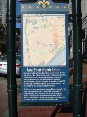
Photographed by Barry Swackhamer, December 27, 2011
1. Canal Street Historic District Marker
Canal Street has hosted carnival parades for almost 150 years, was the first city street to be illuminated with electric lights in 1882, and was the city’s transportation hub with as many as five streetcar tracks on the neutral ground. Following suburban development in the second half of the 20th century, Canal Street’s role as the city’s primary shopping street changed, but it retained its significance as one of New Orleans grandest streets.
Topics. This historical marker is listed in these topic lists: Roads & Vehicles • Settlements & Settlers. A significant historical year for this entry is 1850.
Location. 29° 57.09′ N, 90° 3.976′ W.
this page online

Regionally, this marker is in one of the River Parishes. It is also in the American South, specifically in the Deep South, on the Gulf Coast, and in the Great River Road Region. Globally, it is in North America, a Gulf of Mexico state, the Western Hemisphere, the Western World, and the Anglosphere. Historically, it finds itself in what was once New Spain, the Viceroyalty of New France, the territory of the Mississippian Culture, the Louisiana Purchase, one of the Confederate States of America, and the Antebellum South.
Other nearby markers. At least 8 other markers are within walking distance of this marker: United States Customhouse (within shouting distance of this marker); 114 Magazine Street (about 400 feet away, measured in a direct line); Bienville's Plantation (about 400 feet away); Bank’s Arcade (about 800 feet away); UpStairs Lounge Memorial (approx.
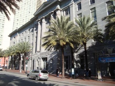
Photographed by Barry Swackhamer, December 27, 2011
2. Canal Street Historic District Marker
The marker is located in front of the U.S. Custom House.
Other markers no longer nearby. Battle of Liberty Place Monument (was approx. 0.2 miles away but has been permanently removed); Whitney National Bank (was approx. 0.2 miles away but has been confirmed missing).
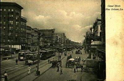
Postcard by Adolph Selige Pub. Co., circa 1905
3. Canal Street. New Orleans, La.
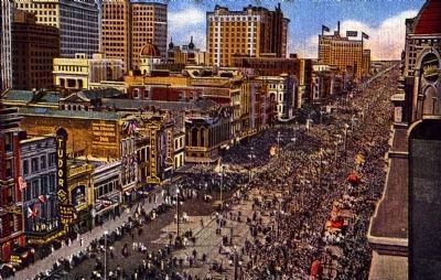
Postcard by the New Orleans News Co., circa 1920
4. Mardi Gras Crowds on Canal Street, New Orleans, La.
The back of the postcard reads: Mardi Gras time, papier mache floats, depicting mythical, historic or phantastic theme, frolicking, masquerading, festive feelings freely expressed without restraint, an outbreak of the love of pleasure that exists in every normal human being.
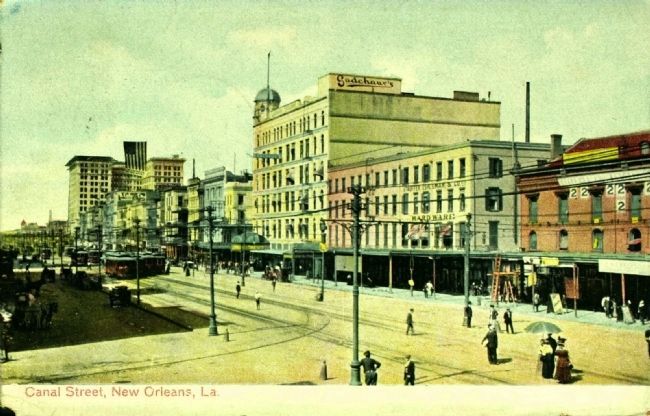
Postcard by Grombach-Faisans Co., Ltd., circa 1908
5. Canal Street, New Orleans, La.
Credits. This page was last revised on February 12, 2023. It was originally submitted on January 13, 2012, by Barry Swackhamer of Brentwood, California. This page has been viewed 1,713 times since then and 111 times this year. Photos: 1, 2. submitted on January 13, 2012, by Barry Swackhamer of Brentwood, California. 3, 4, 5. submitted on February 28, 2015. • Craig Swain was the editor who published this page.
