Radnor - Fort Myer Heights in Arlington in Arlington County, Virginia — The American South (Mid-Atlantic)
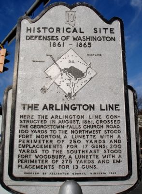
The Arlington Line
Historical Site
— Defenses of Washington 1861 - 1865 —
Erected 1965 by Arlington County, Virginia. (Marker Number 10.)
Topics and series. This historical marker is listed in these topic lists: Forts and Castles • War, US Civil. In addition, it is included in the Defenses of Washington series list. A significant historical year for this entry is 1861.
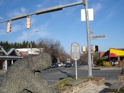
Location. 38° 53.495′ N, 77° 5.044′ W. Marker is in Arlington, Virginia, in Arlington County. It is in Radnor - Fort Myer Heights. Marker is at the intersection of Wilson Boulevard and North Courthouse Road, in the median on Wilson Boulevard. Marker is located in an island between Wilson Boulevard west and Clarendon Boulevard east. Touch for map. Marker is in this post office area: Arlington VA 22201, United States of America. Touch for directions.
Other nearby markers. At least 8 other markers are within walking distance of this marker. Fort Woodbury (about 700 feet away, measured in a direct line); Fort Strong (approx. 0.4 miles away); Fort Cass (approx. half a mile away); The Dawson-Bailey House (approx. half a mile away); Fort Corcoran (approx. 0.6 miles away); John C. McKinney Memorial Stables (approx. 0.6 miles away); ARPANET (approx. 0.6 miles away); The Dawson-Bailey Spring Site (approx. 0.6 miles away). Touch for a list and map of all markers in Arlington.
More about this marker. In the center of the marker is a map of the Washington Defenses, with a red (weathered) arrow pointing out the location of The Arlington Line.
Additional commentary.
1. Fort Morton Particulars
From Mr. Lincoln's Forts: A Guide to the Civil War Defenses of Washington, by Benjamin Franklin Cooling III and Walton H. Owen II:
The site of Fort Morton is today on the grounds of Key Elementary School, near 16th Street and North Custis Road. The fort was named for Brig. Gen. St. Cair Morton, who was killed at Petersburg, Virginia on June 17, 1864. It was first built as a simple open battery between Forts Woodbury and Strong (DeKalb). After 1863 it was stockaded and enclosed.
The 250 yard perimeter allowed for 17 gun emplacements. Armament included six 12-pdr Napoleon guns. No records of the garrisoning units, but most likely detachments from nearby Forts Woodbury and Strong manned the works.
— Submitted February 4, 2008, by Craig Swain of Leesburg, Virginia.
Credits. This page was last revised on February 1, 2023. It was originally submitted on February 4, 2008. This page has been viewed 2,332 times since then and 96 times this year. Photos: 1, 2. submitted on February 4, 2008. • Craig Swain was the editor who published this page.

