Marker Logo HMdb.org THE HISTORICAL
MARKER DATABASE
“Bite-Size Bits of Local, National, and Global History”
Near Daviston in Tallapoosa County, Alabama — The American South (East South Central)
 

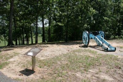
Gun Hill


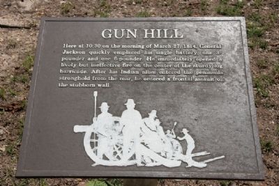
Gun Hill Marker image. Click for full size.
Photographed By TRCP Alliance, June 16, 2011
1. Gun Hill Marker
Inscription. Here at 10:30 on the morning of March 27, 1814, General Jackson quickly emplaced his single battery, one 3-pounder and one 6-pounder. He immediately opened a lively but ineffective fire on the center of the sturdy log barricade. After his Indian allies entered the peninsula stronghold from the rear, he ordered a frontal assault on the stubborn wall.
 
Erected by National Park Service, U.S. Department of the Interior.
 
Topics. This historical marker is listed in these topic lists: Native AmericansWar of 1812. A significant historical date for this entry is March 27, 1814.
 
Location. 32° 58.558′ N, 85° 44.149′ W. Marker is near Daviston, Alabama, in Tallapoosa County. Marker can be reached from Battlefield Park Tour Road. This marker is located at Tour Stop #2 and can be reached by foot. Touch for map. Marker is at or near this postal address: 11288 Horseshoe Bend Road, Daviston AL 36256, United States of America. Touch for directions.
 
Other nearby markers. At least 8 other markers are within walking distance of this marker. Horseshoe Bend Battleground Monument (a few steps from this marker); Major Lemuel P. Montgomery (within shouting distance of this marker); Jackson Trace (within shouting distance of this marker); While the Long Roll Was Beating (about 300 feet away, measured in a direct line); Charge!
Paid Advertisement
Click on the ad for more information.
Please report objectionable advertising to the Editor.
Click or scan to see
this page online
(about 300 feet away); Designed for Defense (about 300 feet away); Futile Escape (about 700 feet away); They Fought to the Last (approx. ¼ mile away). Touch for a list and map of all markers in Daviston.
 
Also see . . .  Horseshoe Bend National Military Park. (Submitted on January 16, 2012, by Timothy Carr of Birmingham, Alabama.)
 
Gun Hill Marker image. Click for full size.
Photographed By TRCP Alliance, June 16, 2011
2. Gun Hill Marker
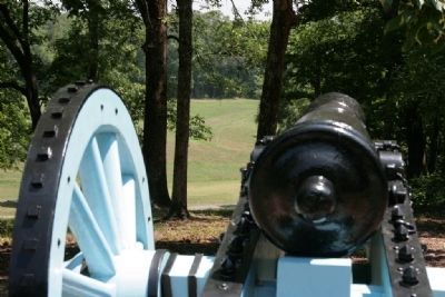
View downrange from the gun position. image. Click for full size.
Photographed By TRCP Alliance, June 16, 2011
3. View downrange from the gun position.
The location of the log barricade can be seen between the trees to the left of the barrel.
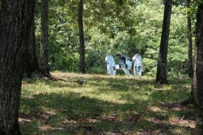
A lone cannon now stands as a silent sentinel to that eventful day in 1814. image. Click for full size.
Photographed By TRCP Alliance, June 16, 2011
4. A lone cannon now stands as a silent sentinel to that eventful day in 1814.
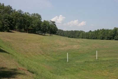
From the log barricade position, the gun placement is to the left behind the tree line. image. Click for full size.
Photographed By TRCP Alliance, June 16, 2011
5. From the log barricade position, the gun placement is to the left behind the tree line.
 
 
Credits. This page was last revised on September 29, 2019. It was originally submitted on January 16, 2012, by Timothy Carr of Birmingham, Alabama. This page has been viewed 866 times since then and 17 times this year. Photos:   1, 2, 3, 4, 5. submitted on January 16, 2012, by Timothy Carr of Birmingham, Alabama. • Craig Swain was the editor who published this page.
Share this page.  
Share on Tumblr
m=51671

CeraNet Cloud Computing sponsors the Historical Marker Database.
This website earns income from purchases you make after using our links to Amazon.com. We appreciate your support.
Paid Advertisement
Apr. 24, 2024