Near Queenston in Niagara Region, Ontario — Central Canada (North America)
The Battle of Queenston Heights
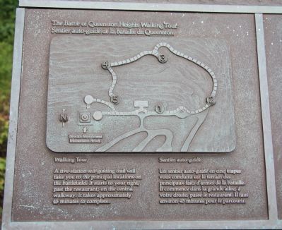
The Battle of Queenston Heights Walking Tour
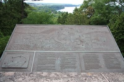
Photographed By Dale K. Benington, July 27, 2011
1. The Battle of Queenston Heights Marker
View of the historical marker at its location at the National Historic Site - Brock's Monument at the lookout, and of the Niagara River Valley which is situated below the lookout, at the base of the Niagara escarpment.
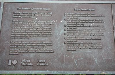
The village below you and the heights on which you are standing were the stage for the famous Battle of Queenston Heights.
It took place during the Anglo-American conflict 1812-1815 known as the War of 1812. During the early morning hours of October 13, 1812 an American invasion force camped at Lewiston crossed the Niagara river and gained control of the heights of Queenston. After many hours of fierce combat, they were crushed by a combined force of British Army regulars, Canadian militia and Indian warriors.
This victory had a great significance. It prevented for sometime the Americans from establishing a foothold in Canada and it inspired confidence in Canadians that they could defend an immense territory despite their meager human and material resources.
A. American attackers' cross the river.
B. British defenders contain the Americans at the landing area.
C. Detachment of Americans secretly scale the steep river cliff behind the British position on Queenston Heights.
D. Americans take the British defensive battery by surprise.
E. British attempt to regain redan battery; British commander, Brock, is killed.
F. Indians harass Americans trying to establish defensive positions.
G. British reinforcements arrive and ascend the heights.
H. British combined force faces Americans in final battle. The latter, trapped between the river and a powerful opposing force, surrender.
Erected by Parks Canada.
Topics. This historical marker is listed in these topic lists: Colonial Era • Native Americans • War of 1812. A significant historical date for this entry is October 13, 1919.
Location. 43° 9.627′ N, 79° 3.194′ W. Marker is near Queenston, Ontario, in Niagara Region. Marker can be reached from Niagara Parkway just north of Portage Road. This historical marker is situated on the Canadian side of the Niagara River in a community/historic park area and is located along a walking trail on the very crest of the Niagara Escarpment, very near and directly north of the Brock Memorial Monument. Touch for map. Marker is at or near this postal address: 14184 Niagara Parkway, Queenston ON L0S 1J0, Canada. Touch for directions.
Other nearby markers. At least 8 other markers are within walking distance of this marker. Sir Roger Hale Sheaffe (a few steps from this marker); Brock's Monument (within shouting distance of this marker); Sir Isaac Brock (within shouting distance of this marker); a different marker also named Brock's Monument (within shouting distance of this marker); The "Colored Corps" 1812 - 1815
(within shouting distance of this marker); a different marker also named The Battle of Queenston Heights (within shouting distance of this marker); The Decisive Battle (within shouting distance of this marker); The Counter-Offensive Takes Shape (about 150 meters away, measured in a direct line). Touch for a list and map of all markers in Queenston.
More about this marker. This historical marker is located in the Queenston Heights National Historic Site of Canada and is on The Battle of Queenston Heights Walking Tour. According to the Niagara Parks web site, this historical marker is located at the "National Historic Site - Brock's Monument at the lookout."
Related markers. Click here for a list of markers that are related to this marker. To better understand the relationship, study each marker in the order shown.
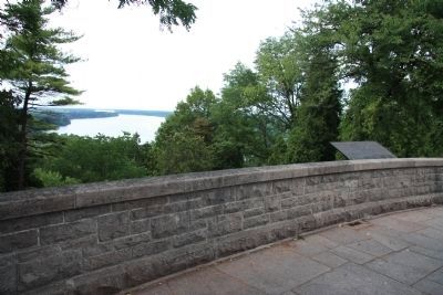
Photographed By Dale K. Benington, July 27, 2011
5. The Battle of Queenston Heights Marker
A`more distant view of the historical marker at its location at the National Historic Site - Brock's Monument at the lookout, and of the Niagara River Valley which is situated below the lookout, at the base of the Niagara escarpment.
Photographed By Dale K. Benington, July 27, 2011
6. The Battle of Queenston Heights Marker
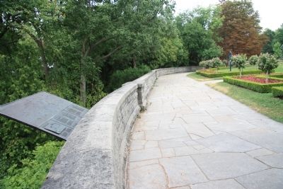
View of the historical marker at the scenic lookout point over the Niagara escarpment, looking east along the park pathway that runs along the crest of the escarpment, that is located just to the north of the Brock Memorial Monument.
Credits. This page was last revised on September 27, 2019. It was originally submitted on January 17, 2012, by Dale K. Benington of Toledo, Ohio. This page has been viewed 1,088 times since then and 27 times this year. Photos: 1, 2, 3, 4, 5, 6. submitted on January 21, 2012, by Dale K. Benington of Toledo, Ohio.
