
Cayce in Fulton County, Kentucky — The American South (East South Central)
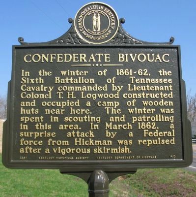
Confederate Bivouac
Photographed by Craig Swain, March 17, 2009
1. Confederate Bivouac Marker
Erected 2007 by Kentucky Historical Society - Kentucky Department of Highways. (Marker Number 1410.)
Topics and series. This historical marker is listed in this topic list: War, US Civil. In addition, it is included in the Kentucky Historical Society series list. A significant historical month for this entry is March 1862.
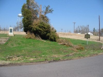
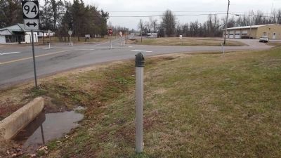
Location. Marker has been reported missing. It was located near 36° 33.338′ N, 89° 1.93′ W. Marker was in Cayce, Kentucky, in Fulton County. It was at the intersection of Jordan Lane (State Road 239) and Moscow Avenue (State Highway 94), on the right when traveling south on Jordan Lane. Touch for map. Marker was in this post office area: Fulton KY 42041, United States of America. Touch for directions.

Regionally, this marker was in Kentucky’s Jackson Purchase. It
this page online
Other nearby markers. At least 8 other markers are within 9 miles of this location, measured as the crow flies: Casey Jones (a few steps from this marker); Isham Browder's Grave (approx. 5.9 miles away); Guerrilla Raids on Clinton (approx. 7.2 miles away); Hickman County Veterans Memorial (approx. 8 miles away); Clinton Seminary (approx. 8 miles away); County Named, 1821 (approx. 8 miles away); First Christian Church (approx. 8.1 miles away); Clinton College (approx. 8.1 miles away).
Photographed by Craig Swain, March 17, 2009
2. Confederate Bivouac and Cacey Jones Markers
Photographed by Ken Smith, January 21, 2012
3. Missing Confederate Bivouac Marker
Credits. This page was last revised on June 16, 2016. It was originally submitted on April 29, 2009, by Craig Swain of Leesburg, Virginia. This page has been viewed 1,808 times since then and 44 times this year. Last updated on January 21, 2012, by Ken Smith of Milan, Tennessee. Photos: 1, 2. submitted on April 29, 2009, by Craig Swain of Leesburg, Virginia. 3. submitted on January 21, 2012, by Ken Smith of Milan, Tennessee.
