Edison in Kern County, California — The American West (Pacific Coastal)
Jedediah Smith Trail
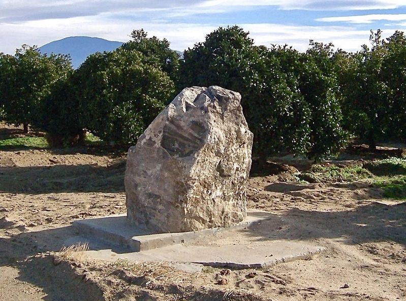
Photographed by Denise Boose, January 2, 2008
1. Jedediah Smith Trail Marker
The marker is missing.
About February 1, 1827, Jedediah Strong Smith, first American to reach Mexican California overland, passed near this spot with his party of fur trappers. From San Gabriel Mission, the group was en route north to a land reported teeming with 'plenty of beaver.' Smith and his men were trailblazers whose exploits soon led to the American conquest of California.
Erected 1958 by California State Parks Commission. (Marker Number 660.)
Topics and series. This historical marker is listed in these topic lists: Exploration • Roads & Vehicles • Settlements & Settlers. In addition, it is included in the California Historical Landmarks series list. A significant historical year for this entry is 1827.
Location. Marker has been reported missing. It was located near 35° 19.928′ N, 118° 48.395′ W. Marker was in Edison, California, in Kern County. It was at the intersection of Bena Road and Towerline Road, on the right when traveling east on Bena Road. This marker is near an orange grove on the southeast corner of Bena Road and Towerline Road. Touch for map. Marker was in this post office area: Edison CA 93220, United
this page online

Regionally, this marker was in California’s San Joaquin Valley, specifically in the Central Valley, and in the Sierra Nevada. It was also on the American Pacific Coast. Globally, it was in North America, on the Ring of Fire, on the Pacific Rim, in the Western Hemisphere, in the Western World, and in the Anglosphere. Historically, it found itself in what was once New Spain and also Mexico’s Alta California.
Other nearby markers. At least 8 other markers are within 11 miles of this location, measured as the crow flies: Rio de San Felipe (approx. 6 miles away); Arvin Veterans (approx. 8.6 miles away); Francisco Garces O.F.M (approx. 8.6 miles away); Arvin-Sierra Glider Port (approx. 9.2 miles away); Weedpatch Camp (approx. 9.4 miles away); Bakersfield National Cemetery (approx. 9½ miles away); Kern County Veterans (approx. 9.6 miles away); Kern River Slough (approx. 10.2 miles away).
Also see . . . California Landmark Foundation. The foundation is raising money to replace missing California Historical Landmark plaques. (Submitted on December 12, 2024.)

Photographed by Denise Boose, March 15, 2009
2. Jedediah Smith Trail Marker
Credits. This page was last revised on December 22, 2024. It was originally submitted on January 22, 2012, by Denise Boose of Tehachapi, California. This page has been viewed 2,008 times since then and 61 times this year. Photos: 1. submitted on December 11, 2024. 2. submitted on January 22, 2012, by Denise Boose of Tehachapi, California. • Syd Whittle was the editor who published this page.
