Fountain Springs in Tulare County, California — The American West (Pacific Coastal)
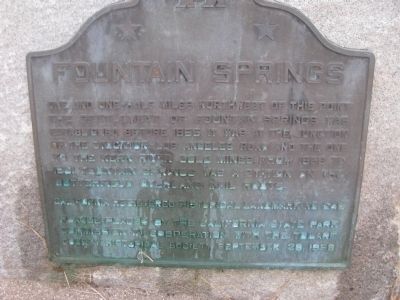
Fountain Springs
Erected 1958 by California State Park Commission in cooperation with the Tulare County Historical Society. (Marker Number 648.)
Topics and series. This historical marker is listed in these topic lists: Roads & Vehicles • Settlements & Settlers. In addition, it is included in the Butterfield Overland Mail, and the California Historical Landmarks series lists. A significant historical year for this entry is 1855.
Location. 35° 53.559′ N, 118° 55.112′ W. Marker is in Fountain Springs, California, in Tulare County. Marker is at the intersection of Avenue 56 (County Route J22) and Old Stage Coach Road, on the right when traveling east on Avenue 56. Located to the right of the Fountain Springs Store/Bar/Restaurant. Touch for map. Marker is in this post office area: Porterville CA 93257, United States of America. Touch for directions.
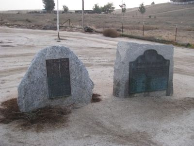
Other nearby markers. At least 8 other markers are within 11 miles of this marker, measured as the crow flies. Old Stage Road (here, next to this marker); "El Cojo" (within shouting distance of this marker); Tailholt (approx. 7 miles away); Dutch Corners (approx. 7.1 miles away); The Original Walker Pass (approx. 8 miles away); Garcés Baptismal Site (approx. 10.1 miles away); Welcome to the Tule River Indian-Reservation (approx. 10.4 miles away); Tule River Indian Reservation (approx. 10.4 miles away). Touch for a list and map of all markers in Fountain Springs.
Credits. This page was last revised on June 16, 2016. It was originally submitted on January 22, 2012, by Denise Boose of Tehachapi, California. This page has been viewed 819 times since then and 65 times this year. Photos: 1, 2. submitted on January 22, 2012, by Denise Boose of Tehachapi, California. • Syd Whittle was the editor who published this page.

