Clemmons in Forsyth County, North Carolina — The American South (South Atlantic)
Wachovia Tract

Photographed by Michael C. Wilcox, January 22, 2012
1. Wachovia Tract Marker
North Carolina History Project website entry
Click for more information.
Click for more information.
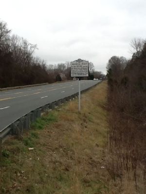
On Dec. 27, 1752, survey for Moravian settlement began near here. Bishop August Spangenberg led frontier expedition that selected 98,985 acres.
Erected 2008 by NC Division of Archives and History. (Marker Number J-110.)
Topics and series. This historical marker is listed in these topic lists: Colonial Era • Religion & Religious Structures • Settlements & Settlers. In addition, it is included in the North Carolina Division of Archives and History series list. A significant historical month for this entry is December 1782.
Location. 36° 1.47′ N, 80° 21.37′ W. Marker is in Clemmons, North Carolina, in Forsyth County. It is at the intersection of South Stratford Road (U.S. 158) and Bryn Mawr Lane (North Carolina Highway 1115), on the right when traveling east on South Stratford Road. Touch for map. Marker is at or near this postal address: 3090 Wade Frye Ln, Winston Salem NC 27103, United States of America. Touch for directions.

Regionally, this marker is in North Carolina’s Piedmont and specifically in Piedmont Triad. It is also in the American South and specifically in the Upper South. Globally, it is in
this page online
Other nearby markers. At least 8 other markers are within 4 miles of this marker, measured as the crow flies: Fraternity Church of the Brethren (approx. ¾ mile away); The "Hattie Butner" (approx. 1½ miles away); Peter and Comfort Clemmons House (approx. 1.6 miles away); Philip and Johanna Hoehns (Hanes) House (approx. 2.1 miles away); McKnight's Meeting House (approx. 2.3 miles away); William Linville (approx. 3.2 miles away); William Johnson (approx. 3.2 miles away); Fries Manufacturing and Power Co. (approx. 3.7 miles away). Touch for a list and map of all markers in Clemmons.
Photographed by Michael C. Wilcox, January 22, 2012
2. Wachovia Tract Marker
Credits. This page was last revised on June 5, 2024. It was originally submitted on January 22, 2012, by Michael C. Wilcox of Winston-Salem, North Carolina. This page has been viewed 1,091 times since then and 52 times this year. Photos: 1, 2. submitted on January 22, 2012, by Michael C. Wilcox of Winston-Salem, North Carolina. • Craig Swain was the editor who published this page.
