South of Broad in Charleston in Charleston County, South Carolina — The American South (South Atlantic)
17 Limehouse Street
Photographed by Mike Stroud, December 29, 2011
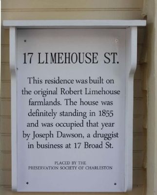
1. 17 Limehouse Street Marker
This residence was built on the original Robert Limehouse farmlands. The house was definitely standing in 1855 and was occupied that year by Joseph Dawson, a druggist in business at 17 Broad St.
Erected by Preservation Society of Charleston.
Topics and series. This historical marker is listed in these topic lists: Architecture • Industry & Commerce • Science & Medicine • Settlements & Settlers. In addition, it is included in the South Carolina, Preservation Society of Charleston series list. A significant historical year for this entry is 1855.
Location. 32° 46.352′ N, 79° 56.224′ W. Marker is in Charleston, South Carolina, in Charleston County. It is in South of Broad. It is on Limehouse Street, on the right when traveling south. Located between Tradd and Gibbes Streets. Touch for map. Marker is at or near this postal address: 17 Limehouse Street, Charleston SC 29401, United States of America. Touch for directions.

Regionally, this marker is in Historic Charleston and in the Lowcountry. It is also in the American South, specifically in the Deep South, and on the Eastern Seaboard. Globally, it
this page online
Other nearby markers. At least 10 other markers are within walking distance of this marker: Tabby Seawall Remnants (within shouting distance of this marker); William Pinckney Shingler House (within shouting distance of this marker); Home of Robert Limehouse (within shouting distance of this marker); The Bowles - Legare House (about 600 feet away, measured in a direct line); 95 Lenwood Boulevard (about 600 feet away); Parker-Drayton House (about 700 feet away); 126 Tradd Street (approx. 0.2 miles away); St. Peter's Episcopal Church Cemetery (approx. 0.2 miles away); 125 Tradd Street (approx. 0.2 miles away); 123 Tradd Street (approx. 0.2 miles away). Touch for a list and map of all markers in Charleston.
Related marker. Click here for another marker that is related to this marker. ..the relationship, more on Limestone
Photographed by Mike Stroud, December 29, 2011
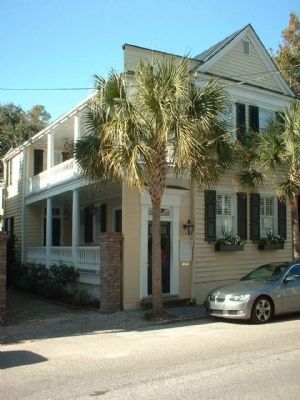
2. 17 Limehouse Street and Marker
Photographed by Mike Stroud, December 29, 2011
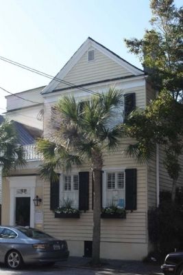
3. 17 Limehouse Street
Credits. This page was last revised on January 24, 2026. It was originally submitted on January 23, 2012, by Mike Stroud of Bluffton, South Carolina. This page has been viewed 2,243 times since then and 92 times this year. Photos: 1, 2, 3. submitted on January 23, 2012, by Mike Stroud of Bluffton, South Carolina.
