Foyil in Rogers County, Oklahoma — The American South (West South Central)
Andrew Hartley Payne
(1907 - 1977)
Photographed by Michael Kindig, May 25, 2003
1. Andrew Hartley Payne Marker
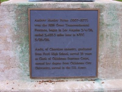
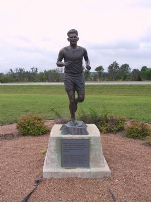
Andrew Hartley Payne (1907 - 1977) won the 1928 Great Transcontinental Footrace, began in Los Angeles 3/4/28, ended 3,422.3 miles later in NYC 5/26/28.
Andy, of Cherokee ancestry, graduated from Foyil High School, served 36 years as Clerk of Oklahoma Supreme Court, earned law degree from Oklahoma City University, served in the U.S. Army.
Topics and series. This historical marker is listed in these topic lists: Indigenous Peoples and Communities • Sports. In addition, it is included in the U.S. Route 66 series list. A significant historical year for this entry is 1928.
Location. 36° 25.619′ N, 95° 31.674′ W. Marker is in Foyil, Oklahoma, in Rogers County. It is on Andy Payne Boulevard just north of Oklahoma Highway 66, on the right when traveling west. Touch for map. Marker is in this post office area: Foyil OK 74031, United States of America. Touch for directions.

Regionally, this marker is in the Cherokee Nation, in Northeast Oklahoma—Green Country, and in Greater Tulsa. It is also in the American South, specifically in the Ozarks, on the prairies, and on the Southern Plains. Globally, it is in North America,
this page online
Other nearby markers. At least 8 other markers are within 9 miles of this marker, measured as the crow flies: Foyil Filling Station (approx. 0.7 miles away); 1928 Route 66 Footrace (approx. 0.7 miles away); Ed Galloway's Totem Pole Park (approx. 4½ miles away); Claremore Mound (approx. 6.6 miles away); Clement Vann Rogers (approx. 8.1 miles away); Daugherty Pathway (approx. 8.2 miles away); Will Rogers Airport (approx. 8.2 miles away); Eastern University Preparatory School (approx. 9 miles away). Touch for a list and map of all markers in Foyil.
Also see . . . Andy Payne. Wikipedia entry (Submitted on July 18, 2024, by Larry Gertner of New York, New York.)
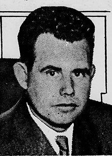
via Wikipedia, 1935
2. Andy Payne
Photographed by Michael Kindig, May 25, 2003
3. Andrew Hartley Payne Marker
Photographed by Michael Kindig, May 25, 2003
4. Andrew Hartley Payne Marker
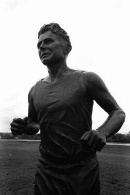
Photographed by Michael Kindig, May 25, 2003
5. Andrew Hartley Payne Marker
Credits. This page was last revised on July 18, 2024. It was originally submitted on January 27, 2012, by Michael Kindig of Elk Grove, California. This page has been viewed 1,255 times since then and 37 times this year. Photos: 1. submitted on January 27, 2012, by Michael Kindig of Elk Grove, California. 2. submitted on July 18, 2024, by Larry Gertner of New York, New York. 3, 4, 5. submitted on January 27, 2012, by Michael Kindig of Elk Grove, California. • Bill Pfingsten was the editor who published this page.
