Rogers in Benton County, Arkansas — The American South (West South Central)
War Eagle Mills Farm
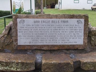
Photographed by Michael Kindig, October 13, 2008
1. War Eagle Mills Farm Marker
Erected 1993.
Topics. This historical marker is listed in these topic lists: Charity & Public Work • Industry & Commerce • Notable Events. A significant historical month for this entry is October 1954.
Location. 36° 16.062′ N, 93° 56.659′ W. Marker is in Rogers, Arkansas, in Benton County. It is on War Eagle Road, on the right when traveling east. Touch for map. Marker is at or near this postal address: 1104 War Eagle Road, Rogers AR 72756, United States of America. Touch for directions.

Regionally, this marker is in Northwest Arkansas, on the Ozark
this page online
Other nearby markers. At least 8 other markers are within 11 miles of this marker, measured as the crow flies: War Eagle Mills (within shouting distance of this marker); War Eagle Mill (about 400 feet away, measured in a direct line); Van Winkle's Mill (approx. 2.2 miles away); Rev. James M. Ingram (approx. 9.4 miles away); Cross Hollows (approx. 9½ miles away); a different marker also named Cross Hollows (approx. 9½ miles away); First Baptist Church (approx. 10.3 miles away); First Free Will Baptist Church (approx. 10.4 miles away). Touch for a list and map of all markers in Rogers.
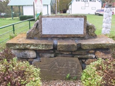
Photographed by Michael Kindig, October 13, 2008
2. War Eagle Mills Farm Marker
Credits. This page was last revised on June 16, 2016. It was originally submitted on January 30, 2012, by Michael Kindig of Elk Grove, California. This page has been viewed 744 times since then and 32 times this year. Photos: 1, 2. submitted on January 30, 2012, by Michael Kindig of Elk Grove, California. • Craig Swain was the editor who published this page.
